A Fond Farewell
The season we hoped would never come is here.
Dear Friends,
It is with a great appreciation and heartfelt emotions that we write to share some sad news. After more than 200 years of sharing a unique blend of weather, wit and wisdom, we’ve made the very difficult decision to write the final chapter of this historical publication. The 2026 Farmers’ Almanac will be our last edition.
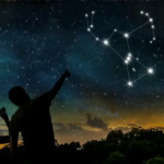
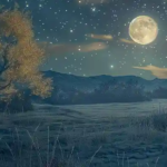
Many of you grew up hearing your parents or grandparents quote from the Almanac, always having a copy nearby. Maybe you have planted by our Moon phases, consulted the Almanac for the “Best Days” to potty train, wean, or go fishing. We’re grateful to have been part of your life and trust that you’ll help keep the spirit of the Almanac alive.
We are incredibly proud of the legacy we leave behind and are filled with gratitude. We appreciate and thank our loyal readers, contributors, and partners who have supported us through the years. Though the Almanac will no longer be available in print or online, it lives on within you.
So go ahead—plant your peas when the daffodils bloom. Watch for a red sky at night. Tell the kids how granddad always swore by the Almanac. That’s how our story stays alive.
With deepfelt appreciation,
Sandi Duncan and Peter Geiger
Editor and Editor Emeritus
P.S. The 2026 Farmers’ Almanac is currently sold out in the FA Store, but you may be able to find a copy at your local grocery or bookstore. Beginning December 1, 2025 our website will be restricted to this page. If you are a Member, please check your inbox for more information about your subscription. Questions? Contact [email protected].

This article was published by the Staff at FarmersAlmanac.com. Any questions? Contact us at [email protected].
- Farmers' Almanac Staffhttps://www.farmersalmanac.com/author/fa-admin

- Farmers' Almanac Staffhttps://www.farmersalmanac.com/author/fa-admin

- Farmers' Almanac Staffhttps://www.farmersalmanac.com/author/fa-admin
- Farmers' Almanac Staffhttps://www.farmersalmanac.com/author/fa-admin


I’m so sad with this terrible news. Please don’t stop the almanac! I even plan my haircut on the best day for me. We all need the great farmers almanac advice and weather predictions. I’ve loved the almanac since I was a child.
This is the worst news ever! I but the Farmer almanac every year and grew up to live by it with my grandparents also! This SUCKS!
Let’s all subscribe , I trust this more than our current media
Why can’t this book every year tell where the snow what goes around globe we still need this book please don’t let this be last book I remember my grandma had this book over time it good we need this book please keep it going we need it I need to our kids in near future please don’t take it away I live in Oklahoma City and we don’t get much snow it fun to play in not so much driving in it .. I glad we don’t get the snow ❄️🌨️ it pretty you see other places but to drive in it no not so much please keep the book it the best if you take some of ad
I feel like I’ve lost a parent again. Through tears, I say thank you for all the years, you will be truly missed.
This is very sad to me. I use the Farmers Almanac for so many things. Thank you for all of the years you have been a part of my life. You will be missed.
I am so disappointed. I relied on this book every year from planning what I would have to wear to work to planning vacations and trips and planning when to watch for a meteor shower or an eclipse. I read the stories to my students and learned things I would otherwise never know about and planted my garden accordingly. I’ve kept past copies just for the information that is in them. Why isn’t the almanac going to be online?
I had hoped there was something we could do to save the almanac. My great grandmother, even went by the almanac and my grandparents and my parents. I have used the almanac as far back as I can remember and I’ve passed it to my children. Now their children won’t have anything like this to read or go by when planting. Almanac has been around so long it’s unbelievable there will no longer be an almanac, you will sorely be missed. ☹️
I’m so sorry to hear this. I look forward to reading the almanac each year. It makes me sad.
This just sucks… like really sucks 🙁