
Peak Hurricane Season Is Here—Why September 10 Matters Even in a Quiet 2026

The Atlantic hurricane season reaches its climatological peak around September 10. Here’s why storms are historically most likely now—and why NOAA’s below-normal 2026 outlook is no reason to let your guard down.
The calendar may be edging toward fall, but in the tropical Atlantic, hurricane season is entering its most important stretch.
September 10 marks the climatological peak of Atlantic hurricane season, according to the National Hurricane Center. The official season runs from June 1 through November 30, but historical records show a pronounced surge in activity from about mid-August through mid-October, with the curve reaching its highest point around September 10.
That date is especially interesting in 2026.
NOAA’s updated August outlook says this Atlantic hurricane season is most likely to finish below normal, with a 75% probability of below-normal activity, a 20% chance of a near-normal season and only a 5% chance of an above-normal season. NOAA is calling for 7 to 13 named storms, 2 to 6 hurricanes and 0 to 2 major hurricanes for the full season.
But that doesn’t mean September is harmless.
A quieter-than-average hurricane season can still produce a destructive storm, and seasonal forecasts do not predict whether or where an individual hurricane will make landfall. As NOAA stresses, two seasons with similar overall activity can have dramatically different impacts.
So why does hurricane activity peak so consistently around September 10?
The answer comes down to a remarkable seasonal alignment of warm ocean water, atmospheric winds and disturbances moving westward from Africa.
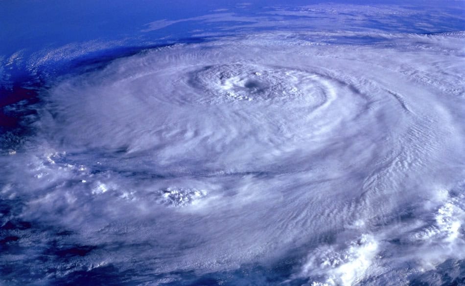
Why Does Atlantic Hurricane Season Peak Around September 10?
Hurricanes need several ingredients to come together at the same time.
By late August and early September, many of those ingredients are historically close to their most favorable levels across the tropical Atlantic.
1. The Atlantic Has Had All Summer To Warm Up
It may seem logical that the hottest ocean temperatures would arrive during the hottest days of July, but oceans warm and cool much more slowly than the atmosphere.
That creates a seasonal lag.
After months of strong summer sunshine, large areas of the tropical Atlantic, Caribbean and surrounding waters are typically very warm by late August and September. That warm water supplies the heat and moisture that tropical cyclones need.
NOAA notes that increasingly warm ocean temperatures are one of the principal reasons Atlantic activity historically ramps up as summer progresses.
Warm water alone, however, cannot make a hurricane.
The atmosphere above it has to cooperate too.
2. Wind Shear Is Often More Favorable
One of a hurricane’s biggest enemies is vertical wind shear—a change in wind speed or direction as you move higher through the atmosphere.
Imagine trying to stack a tower of blocks while someone keeps pushing the top sideways. Strong wind shear can do something similar to a developing tropical cyclone, separating thunderstorms from the storm’s center and disrupting its circulation.
Historically, wind shear over portions of the Atlantic tends to decline through summer and can become particularly favorable for development by late August and early September. NOAA identifies the combination of warm water and relatively weak wind shear as a major reason hurricane activity reaches its seasonal maximum around this time.
That makes September a period when tropical disturbances have a better chance of organizing—and, given the right conditions, intensifying.
3. Tropical Waves Keep Rolling Off Africa
September is also prime time for disturbances known as African easterly waves.
These weather systems travel westward from Africa into the tropical Atlantic. Most never become hurricanes, but some provide the initial area of thunderstorms and rotation from which a tropical depression can eventually develop.
September is particularly notable because storms can form over a huge portion of the Atlantic basin. NOAA hurricane-training material describes September as the climatological peak and notes that powerful, long-track Cabo Verde hurricanes are especially possible during this period.
Those storms originate far out in the eastern tropical Atlantic, giving them potentially thousands of miles of warm ocean over which to organize and intensify.
September 10 Is a Peak—Not a Deadline
There is nothing magical about midnight on September 10.
It does not mean hurricanes suddenly become more likely on September 10 and less likely on September 11.
Rather, climatologists have looked at decades of Atlantic hurricane activity and plotted how frequently tropical storms and hurricanes occur on each day of the year. The resulting curve climbs sharply during August, reaches its highest point around September 10, and then gradually declines through autumn.
The National Hurricane Center’s climatology shows that most Atlantic tropical cyclone activity occurs from mid-August through mid-October.
In other words, think of September 10 as the summit of a broad hill rather than a single dangerous day.
And historically, plenty happens near that summit.
NOAA has noted that roughly three-quarters of Atlantic hurricane seasons during the satellite era had at least one named storm active around September 10, while roughly half had at least one active hurricane.
So Why Is 2026 Expected To Be Quieter?
This year contains an interesting conflict between the calendar and the atmosphere.
September may traditionally provide some of the best conditions of the year for Atlantic hurricanes, but a strengthening El Niño is working against those conditions in 2026.
NOAA’s August 6 update concluded that a below-normal Atlantic hurricane season is now the most likely outcome. The agency expects El Niño to continue strengthening through the peak months of hurricane season.
You can learn more about the phenomenon in our Farmers’ Almanac guide to what El Niño is and how it affects weather.
One of El Niño’s most important effects on Atlantic hurricanes is increased upper-level wind shear.
That shear can tilt, disrupt or sometimes tear apart developing tropical systems before they have an opportunity to strengthen.
NOAA’s forecast models are predicting above-normal vertical wind shear across the Atlantic’s Main Development Region during the heart of the season, enough to counteract some otherwise favorable conditions over the ocean.
That is a major reason NOAA’s August forecast was reduced to:
| 2026 Atlantic outlook | NOAA forecast |
|---|---|
| Named storms | 7–13 |
| Hurricanes | 2–6 |
| Major hurricanes | 0–2 |
| Chance of below-normal season | 75% |
For comparison, the 1991–2020 seasonal averages are approximately 14 named storms, 7 hurricanes and 3 major hurricanes.
A Below-Normal Season Can Still Produce a Major Hurricane
This is probably the most important point to remember.
“Below normal” describes the Atlantic basin as a whole. It does not describe the risk to your home.
A hurricane season can have relatively few storms yet still produce one hurricane that strikes a populated coastline.
NOAA explicitly warns that its seasonal outlook is not a landfall forecast. Seasonal forecasts cannot tell us months ahead where an individual storm will form, which direction it will travel or whether it will reach land.
And it only takes one.
That is why coastal residents should not interpret a quiet August—or a below-normal seasonal forecast—as an all-clear.
If you live in a hurricane-prone area, review our hurricane preparedness and safety guide, including what to do before, during and after a storm.
What Happens After September 10?
Hurricane season does not end when the climatological peak passes.
Far from it.
Atlantic activity typically remains elevated well into October, particularly across the western Caribbean, Gulf and western Atlantic.
As autumn progresses, the favored areas for storm formation gradually shift. Water temperatures eventually cool, atmospheric patterns become less supportive and stronger fronts begin dipping farther south.
But October has produced many memorable hurricanes, and tropical storms can even occur in November.
The official Atlantic hurricane season does not end until November 30.
So while September 10 represents the historical high-water mark, residents from the Caribbean and Gulf Coast to Florida and the Eastern Seaboard still have many weeks of hurricane season ahead.
Know the Difference: Tropical Storm, Hurricane and Major Hurricane
A tropical cyclone receives a name when its sustained winds reach 39 mph.
At 74 mph, it becomes a hurricane.
At 111 mph, it reaches Category 3 and is classified as a major hurricane.
Our complete Saffir-Simpson Hurricane Scale guide explains all five hurricane categories and the wind speeds associated with each.
You can also follow this season’s storms with our complete list of 2026 Atlantic hurricane names.
The Bottom Line
September 10 is historically the peak of Atlantic hurricane season because several hurricane-friendly ingredients tend to overlap at once: very warm ocean water, traditionally favorable atmospheric winds and a steady supply of tropical disturbances crossing the Atlantic.
The unusual wrinkle in 2026 is El Niño.
NOAA now expects the year to finish below normal overall, largely because stronger wind shear should suppress some Atlantic storm development. But that seasonal forecast should not be confused with a prediction that no dangerous hurricane will occur.
For anyone living along the Atlantic or Gulf coasts, the message is simple:
The calendar says we have reached peak hurricane season. Stay prepared, keep watching the tropics, and remember that a quiet season only stays quiet until it doesn’t.
For the latest official tropical forecasts and watches, consult the National Hurricane Center.

- Tim Konrad

- Tim Konrad
- Tim Konrad
- Tim Konrad