Dixie Alley: The Other Tornado Belt You Should Know About

Quick Reference
- What it is: A secondary tornado-prone region in the southeastern US, distinct from classic Tornado Alley. Term coined by NOAA’s Allen Pearson in 1971.
- States included: Mississippi, Alabama, Arkansas, Louisiana, Tennessee, plus parts of Georgia, Kentucky, South Carolina, and North Carolina.
- Why it is deadlier: Nighttime tornadoes (2.5x more fatal), high mobile-home density (15-20x death risk), tree cover, rain-wrapped storms, and a longer season.
- Most active state: Mississippi, averaging about 115 tornadoes a year, far above the national state average.
- Unique season pattern: Two peaks. Spring (Feb to mid-April) AND a secondary surge in November and December that exists nowhere else in the US.
- Worst recent outbreak: The 2011 Super Outbreak. 368 tornadoes, four EF5s, 348 deaths, $10.2 billion in damage.
Mississippi sees about 115 tornadoes a year, more than any other state per capita, and Tennessee logs the highest share of nighttime tornado fatalities in the country at over 73 percent. Both states sit inside Dixie Alley, the secondary tornado belt that runs across the Deep South. Classic Tornado Alley out on the Plains gets the storm-chaser footage. Dixie Alley gets the funerals. Below is what the term means, why this region runs deadlier per tornado, and how the geography is shifting in a way that puts more people in its path every year.
What is Dixie Alley?
Dixie Alley is the informal name for a secondary tornado-prone region in the southeastern United States. The term was coined in 1971 by Allen Pearson, then director of the National Severe Storms Forecast Center, the predecessor to today’s NOAA Storm Prediction Center. Pearson used it to flag a region that produces fewer total tornadoes than Tornado Alley but consistently higher death tolls.
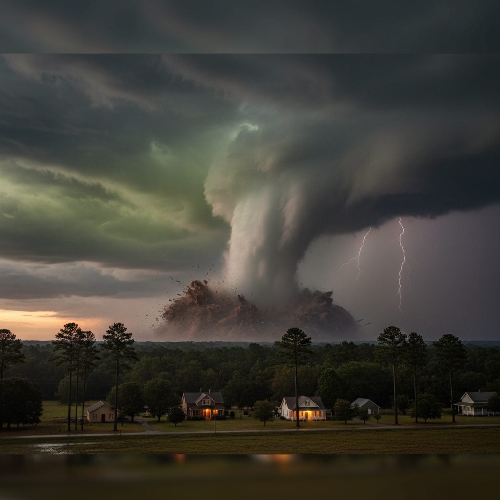
The core states are Mississippi, Alabama, Arkansas, Louisiana, and Tennessee. The footprint stretches into parts of Georgia, Kentucky, southeastern Missouri, upstate South Carolina, and western North Carolina. The region’s defining feature is access to deep, warm Gulf of Mexico moisture, which fuels the high-precipitation supercells that dominate Dixie Alley severe weather. These storms wrap their tornadoes in heavy rain, a condition meteorologists call rain-wrapped, and that visibility problem is part of why the region is so dangerous.
Why Dixie Alley Is Deadlier Than Classic Tornado Alley
Dixie Alley produces fewer tornadoes per year than the classic Tornado Alley of Oklahoma and Kansas. It produces more tornado deaths. Five overlapping factors explain the disparity.
1. Nighttime tornadoes. Tornadoes that strike after dark are roughly 2.5 times more likely to kill people than daytime tornadoes, because most residents are asleep and weather alerts have to wake them. The Gulf of Mexico keeps the air over Dixie Alley unstable long after sunset, which is why Tennessee, Arkansas, Alabama, and Mississippi all see a majority of their tornado deaths at night. Tennessee is the worst offender at over 73 percent.
2. Mobile home density. A tornado that hits a manufactured home produces 15 to 20 times the death risk of one that hits a stick-built house. Dixie Alley has the highest concentration of manufactured housing in the country. Mississippi sits at about 15 percent, South Carolina at 14.2, and Louisiana at 12.6, all above the US average. Mobile homes account for only about 8 to 12 percent of housing stock in the region but generate 53 percent of tornado deaths in homes.
3. Tree cover and rain-wrapped storms. Pine forest, hardwoods, and rolling terrain block sightlines. By the time a Mississippi family hears the train-roar, the tornado is already on the lawn. Heavy rain wrapped around the funnel makes visual confirmation impossible. Plains tornadoes, by contrast, are visible across the wheat for miles.
4. A longer and offset season. Tornado Alley peaks once, in May and June. Dixie Alley peaks twice, in February to mid-April and again in November and December. That late-fall second peak is unique in the country and is driven by faster jet-stream winds that produce faster-moving tornadoes. Faster ground speed means less reaction time.
5. Higher population density and weaker shelter infrastructure. The Plains have storm cellars baked into local building tradition. The Southeast does not. Add denser populations and you get more people in the path with fewer hardened places to go.
Notable Dixie Alley Tornado Outbreaks
2011 Super Outbreak (April 25 to 28, 2011). The largest tornado outbreak in US history. Over four days, 368 confirmed tornadoes touched down. April 27 alone produced 224 of them, the most active tornado day ever recorded. The outbreak generated four EF5s and eleven EF4s. The four EF5 tornadoes hit Philadelphia and Kemper County in Mississippi, Hackleburg-Phil Campbell-Tanner-Harvest in Alabama, Smithville Mississippi into Shottsville Alabama, and Fyffe-Rainsville-Sylvania Alabama into Rising Fawn Georgia. Total death toll: 348, with Alabama alone losing 238 lives. Damage ran $10.2 billion in 2011 dollars per NOAA NCEI.
March 3, 2019 outbreak. A six-hour severe-weather event spawned 42 tornadoes across Alabama, Georgia, Florida, and South Carolina. The deadliest was an EF4 that ran 68.6 miles from Beauregard through Smiths Station, Alabama, into Talbotton, Georgia, with peak winds of 170 mph and a 76-minute lifespan. It killed 23 people in Lee County, Alabama, the worst tornado in the county since 1875 and the deadliest US tornado since the 2013 Moore, Oklahoma storm.
March 31 to April 1, 2023 outbreak. A multi-day outbreak produced more than 145 tornadoes across the southern and central US, with the heaviest damage concentrated across Dixie Alley. NOAA pegged total damage at about $5.7 billion, a reminder that the region’s worst outbreaks are not historical artifacts but a current and ongoing threat.
State-by-State Tornado Frequency
Mississippi. Roughly 115 tornadoes a year on a five-year running average, the highest in Dixie Alley and far above the national state-average of about 24. Mississippi has logged the most tornadoes of any state across the past five years.
Alabama. About 90 tornadoes a year on the 2018 to 2022 baseline. The state took the brunt of the 2011 Super Outbreak and continues to log catastrophic events at a regular cadence.
Tennessee. Lower raw count than Mississippi or Alabama, but the deadliest fatality profile in the country, with more than 73 percent of tornado deaths happening at night per NWS data.
Louisiana, Arkansas, Georgia. Each averages 30 to 50 tornadoes a year, with Louisiana additionally exposed to Gulf hurricane spawn. In 2022, Mississippi, Alabama, and Texas combined for 31 percent of all US tornadoes. For more on how those tornado losses fit a wider state-by-state weather risk picture, see our piece on the worst weather states in the US.
Tornado Alley Is Migrating Into Dixie Alley
Peer-reviewed research from Victor Gensini at Northern Illinois University has documented a 400 to 500 mile eastward migration of tornado activity over the past forty years. Tornadoes that used to concentrate in northeastern Texas and south-central Oklahoma now show up more often in eastern Missouri, Arkansas, western Tennessee and Kentucky, and northern Mississippi and Alabama. In other words, classic Tornado Alley is moving into Dixie Alley.
The drivers are physical and well-documented. The American Southwest has been in a long-running drought, which produces a high-pressure dome that suppresses storm formation in its lee. The dry line, the boundary between dry desert air and humid Gulf air, has shifted about 140 miles east since the late 1800s. Gulf of Mexico water temperatures are 1 to 2 degrees Celsius warmer than mid-century averages, providing more moisture to the convective engine. The jet stream sits further south more often than it did, parking moisture over the Mississippi Delta in seasons it once skipped. The implication is that Dixie Alley’s hazard burden is rising in a region that is less prepared, on average, to absorb it.
The climate-driver context is part of a larger pattern. For background on the seasonal patterns that influence severe weather across the country, see our explainers on El Nino and La Nina.
Shelter and Safety in Dixie Alley
Dixie Alley’s lethality profile means safety advice that works in Tornado Alley is not enough here. Three rules carry the most weight.
If you live in a manufactured home, leave it for any tornado warning. Per FEMA P-320 standards, a properly engineered above-ground safe room can withstand 250 mph winds, but it must be anchored to a reinforced concrete slab at least 4 inches thick with rebar or post-tension cable. If your home does not have that, your shelter plan is to leave for a community shelter or a reinforced public building before the storm arrives, not when it is on top of you.
Get a NOAA Weather Radio with battery backup. Dixie Alley tornadoes hit at night. Phone alerts can fail. A weather radio that wakes you out of a sound sleep is the difference between sheltering and sleeping through it.
Have a written shelter plan with multiple exit routes. Trees come down across rural roads in the South in seconds. A single planned route is one tree away from being closed. Practice the drill before the season starts, in late January for the spring peak and again in late October for the fall peak.

Frequently Asked Questions
What states are in Dixie Alley?
The core Dixie Alley states are Mississippi, Alabama, Arkansas, Louisiana, and Tennessee. The footprint extends into parts of Georgia, Kentucky, southeastern Missouri, upstate South Carolina, and western North Carolina.
Why is Dixie Alley more dangerous than Tornado Alley?
Dixie Alley produces fewer total tornadoes than Tornado Alley but more tornado deaths because of nighttime occurrence, high mobile-home density, tree cover that hides approaching storms, rain-wrapped tornadoes, a longer season, and weaker shelter infrastructure across the region.
When is Dixie Alley tornado season?
Dixie Alley has a bimodal tornado season. The primary peak runs from February through mid-April. A secondary peak runs in November and December that does not occur anywhere else in the US, driven by faster cool-season jet-stream winds and persistent Gulf moisture.
Which Dixie Alley state has the most tornadoes?
Mississippi averages roughly 115 tornadoes a year, the highest in Dixie Alley and well above the national state average of about 24. Alabama follows at about 90 a year.
Is Tornado Alley shifting into Dixie Alley?
Yes. Peer-reviewed research from Northern Illinois University documents a 400 to 500 mile eastward shift in tornado activity over the past forty years. Drivers include long-term Southwest drought, a 140-mile eastward shift in the dry line since the late 1800s, warmer Gulf of Mexico water, and a more southerly jet-stream position.
Who coined the term Dixie Alley?
Allen Pearson, then director of NOAA’s National Severe Storms Forecast Center, coined the term in 1971 to describe a southeastern region with fewer tornadoes than the Plains but a higher death rate per tornado.


- Josh Morley

- Josh Morley
- Josh Morley