10 Worst Weather States in the US: Ranked by Tornadoes, Hurricanes, and Hail

Quick Reference
- #1 worst weather state: Texas. 155 tornadoes a year, 190 billion-dollar disasters since 1980, every major hazard type.
- Most billion-dollar disasters: Georgia at 134, the highest frequency of any state per NOAA NCEI.
- Most hurricane landfalls: Florida, with more than 120 documented since 1851.
- Most flood disasters: Louisiana, with 10 billion-dollar flood events, the highest of any state.
- Hail capital: Colorado. 94 hail events per year and 38 billion-dollar hailstorms since 1980.
- Ranked by: tornado frequency, NOAA billion-dollar disaster count, hurricane landfalls, severe storm and hail incidence, and temperature extremes.
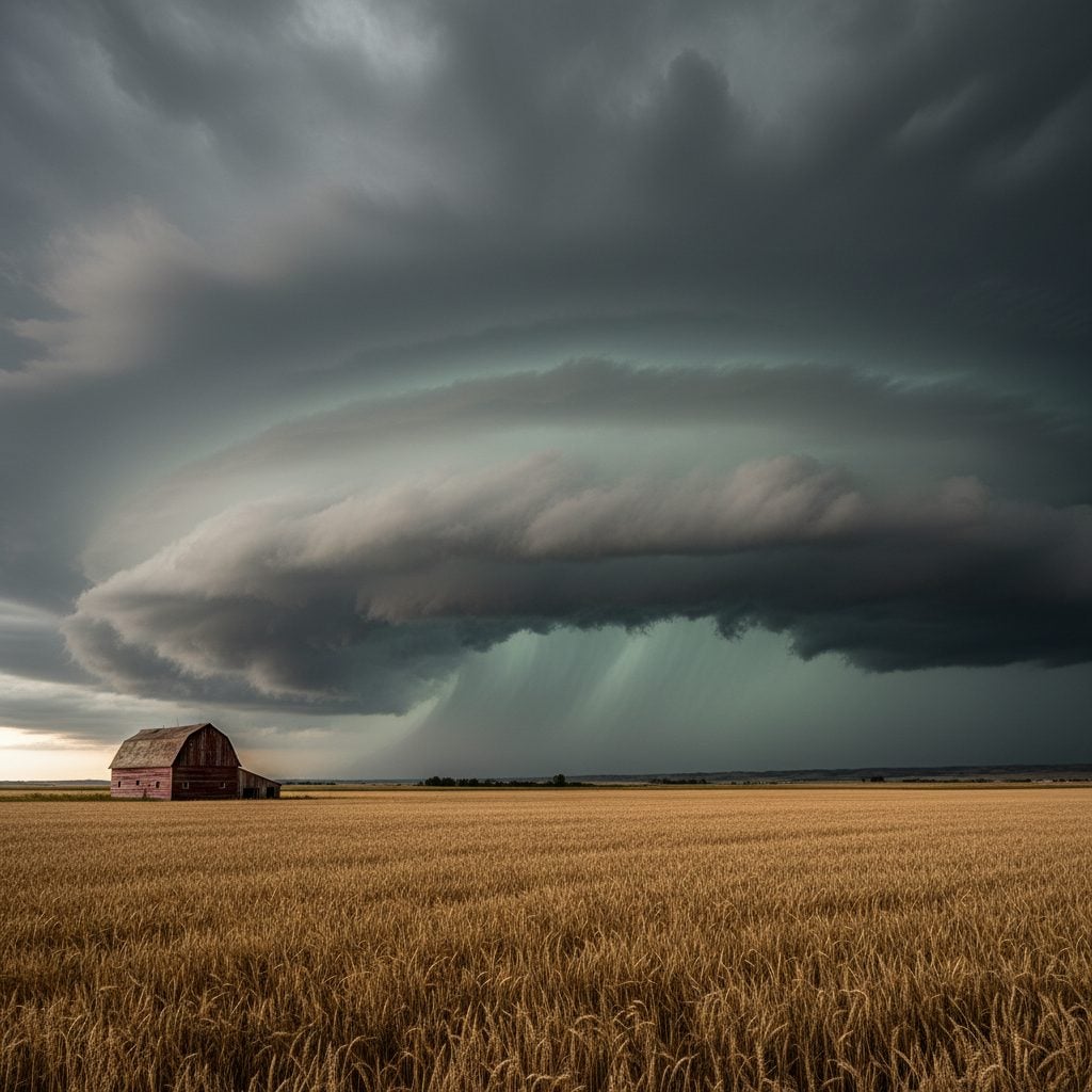
Texas logs about 155 tornadoes a year, has racked up 190 billion-dollar weather disasters since 1980, and is the only state in the country that has to plan for tornadoes, hurricanes, hailstorms, derechos, wildfires, droughts, and flash flooding in the same calendar. That is how a place most travelers picture as wide open and sunny ends up at the top of the worst weather states list. The ranking below uses long-run NOAA data, not a single bad season, and it tracks the chronic weather burden a resident actually lives with year after year.
How We Picked the Worst Weather States
Worst is a slippery word, so the ranking has to be tied to numbers. The list below weighs five factors equally, all drawn from federal data: tornado frequency from the NOAA Storm Prediction Center, the count of billion-dollar weather and climate disasters from NOAA NCEI covering 1980 to 2024, hurricane and tropical cyclone landfalls from the National Hurricane Center, severe thunderstorm and hail incidence from National Weather Service warning records, and temperature extremes from the NOAA Climate Extremes Index.
A few notes before you read on. Severity here is composite, not single-event. A state earns a spot for facing many hazard types across the year, not for one historic storm. The list is also US-only, fifty states. Territories are not ranked. And the rankings are about exposure and frequency, not whether residents like the weather. If you love four seasons of severe storms, Oklahoma will look like home; if you do not, you will have read enough by item three.
The 10 Worst Weather States in the US
1. Texas. Texas tops the list because it pulls every lever at once. The state averages 155 tornadoes a year, the highest absolute count in the country. Since 1980 it has logged 190 billion-dollar weather and climate disasters, including 126 severe storms, hurricanes from Carla to Harvey, drought after drought, and historic hail. Hurricane Harvey in 2017 alone delivered roughly 60 inches of rain to the Houston area and caused about $160 billion in damage. Between 2018 and 2022, the National Weather Service issued 137,523 watches, warnings, and advisories for Texas. The trade-off Texans hear all the time is “everything is bigger here.” Weather included.
2. Florida. Florida holds the national record for hurricane landfalls, with more than 120 documented since 1851. Since 1980, the state has racked up roughly 80 billion-dollar weather disasters, 36 of them hurricanes or tropical cyclones. Hurricane Ian in 2022 came ashore as a Category 4 with 150 mph winds, drove a 10 to 15 foot storm surge into southwest Florida, destroyed or damaged more than 30,000 homes, and ran a damage bill of about $112 billion. The peninsula is the only state exposed to both Atlantic and Gulf storm tracks, which is why hurricane season here lasts five months in fact and twelve months in mind.
3. Louisiana. Louisiana has logged 10 billion-dollar flood events since 1980, the highest count of any state, on top of repeated Category 3 and 4 hurricane landfalls. Hurricane Katrina in 2005 caused about $201.3 billion in damage in 2024 dollars, the costliest US hurricane on record, and is responsible for 1,833 deaths. Hurricane Ida in 2021 came ashore as a Category 4 sixteen years to the day after Katrina. Most of metro New Orleans sits below sea level, which is why a Louisiana resident learns levee terminology the way other Americans learn weekend forecasts.
4. Kansas. Kansas sits near the heart of Tornado Alley and ranks second nationally with about 96 tornadoes a year. Between 1950 and 2016, the state recorded 49 violent tornadoes rated EF4 or stronger. About 60 to 70 percent of Kansas tornado activity hits between April and June. The state has logged 128 billion-dollar disasters since 1980, third-highest in the country, and counts large hail and damaging derecho winds among its yearly hazards. The 2007 EF5 tornado that struck Greensburg destroyed roughly 95 percent of the town. A Kansas spring sky can turn green in the time it takes to bring in the laundry.
5. Oklahoma. Oklahoma averages 68 tornadoes a year and has produced 65 EF4-or-stronger tornadoes since 1950, one of the highest violent-tornado counts in the country. The May 2013 Moore tornado was a long-lived multivortex storm that took 23 lives and demolished an elementary school. The state has logged 120 billion-dollar disasters since 1980 and faces large hail, derecho winds, and severe heat with regularity. Oklahoma also sees more felt earthquakes now than it did in 2000, owing to wastewater injection from oil and gas operations. The local joke that you can experience all four seasons in a single spring afternoon is a joke because it is true.
6. Colorado. Colorado is the hail capital of the United States. The state averages about 94 hail events a year and roughly $151 million in annual hail damage, and has seen 38 billion-dollar hailstorms since 1980. The 2023 hail season set a state record, with 34 reports of hail at least three inches across, a threefold increase from 2019. The mountain-plains geography also produces blizzards in April and May, summer flash floods, and explosive wildfire weather. The Marshall Fire in Boulder County in December 2021 destroyed more than 1,000 structures and ran $513 million in damage. Coloradans plan for snow and shop for hail nets in the same week.
7. Missouri. Missouri sits at the meeting place of Gulf moisture, plains tornadoes, and major river flooding. The state has recorded 2,555 tornadoes since 1950, with May as the peak month. St. Louis alone accounts for 68 of those tornado events, the highest concentration in the state. Missouri has logged 120 billion-dollar disasters since 1980, faces flooding from both the Mississippi and Missouri Rivers, and sees regular winter ice storms. A 2020 derecho carved across the southern half of the state with 60-plus mph winds, large hail, and three to five inches of rain in a few hours.
8. Georgia. Georgia leads the country in raw billion-dollar disaster frequency, with 134 events since 1980 per NOAA NCEI. Cumulative damage exceeds $150 billion. The state catches Atlantic hurricane landfalls, tropical cyclone remnants that stall and dump rain, spring tornado outbreaks, summer thunderstorms, ice storms in the foothills, and severe heat in the south. Hurricane Helene in 2024 spawned tornadoes across the state and produced significant inland flooding. The breadth of hazards is what puts Georgia near the top, even when no single storm dominates the headline.
9. Illinois. Illinois sits in the Midwest severe-weather corridor and has logged 128 billion-dollar disasters since 1980. The August 2020 Midwest derecho crossed the state with 80-plus mph winds, hail, and tornadoes, and remains one of the costliest thunderstorm complexes in US history. Tornado activity averages 15 to 25 a year, Mississippi River flooding is a recurring threat, and the Chicago area pulls in lake-effect snow and brutal winter wind off Lake Michigan. Add ice storms in central Illinois and the state runs the full severe-weather menu.
10. North Carolina. North Carolina has logged 121 billion-dollar disasters since 1980 and faces a rising threat from tropical systems that stall and unload rain on the Appalachian foothills. Hurricane Florence in 2018 dropped more than 20 inches of rain on parts of the state and ran a damage bill above $24 billion. Hurricane Helene in 2024 dumped over 30 inches of rain in some western North Carolina mountain locations and produced catastrophic flooding far from the coast. Spring tornadoes, ice storms in the Piedmont, and elevation-driven snowfall round out the hazard list.
Tornadoes, Hurricanes, and Hail: Where the Numbers Cluster
Three hazard categories explain most of this list. Tornadoes concentrate in a corridor that runs from northern Texas through Oklahoma, Kansas, Missouri, and Illinois. Hurricane landfalls cluster on the Gulf and South Atlantic coasts, which is why Florida, Louisiana, Texas, Georgia, and North Carolina all appear. Hail damage centers on the high plains, with Colorado and Texas absorbing the worst of it. A state usually earns a top-10 slot by sitting at the intersection of two of those clusters, not just one.
For more on the seasonal climate drivers behind these patterns, see our explainers on what El Nino is and what La Nina is. For the storm types that drive much of the damage, our hurricane names reference and historic blizzards archive cover the named events.
Worst Weather States vs. Worst Weather Cities
State rankings and city rankings tell different stories. Cities live or die by their own microclimate, which is why a state with mostly mild weather can still have a single brutal city, and a state on the worst list can have a few pleasant ones. Our companion piece on the 10 worst weather cities uses sunshine, precipitation, humidity, and temperature as the lens. The state list above uses disaster frequency and chronic hazard exposure. Use both. A retiree picking a town wants the city number; an emergency manager picking a state wants the disaster number.
If you want a finer cut on chronic conditions, see America’s stormiest cities, which ranks by lightning and severe-storm days, and top 10 cloudiest US states, which is a different cut on bad weather entirely.
Sources and Methodology Notes
All disaster counts are drawn from the NOAA NCEI Billion-Dollar Weather and Climate Disasters database, which tracks events whose damage exceeds $1 billion in CPI-adjusted dollars. Tornado counts are state averages from the NOAA Storm Prediction Center WCM tornado statistics. Hurricane data comes from the National Hurricane Center and FEMA disaster declarations. Severe storm and hail data comes from the Insurance Information Institute compilations of NWS warning records.
Disaster counts run through 2024; partial-year totals were excluded. Tornado averages cover the full instrumental record from 1950, with the post-1990 period weighted more heavily because Doppler radar improved tornado detection. The ranking is descriptive, not predictive. A quiet year does not move a state down the list, and a single bad year does not move one up.

Frequently Asked Questions
What is the worst weather state in the US?
Texas is the worst weather state in the US by composite NOAA data. It logs the most tornadoes, has 190 billion-dollar weather disasters since 1980, and is the only state exposed to all major hazard categories: tornadoes, hurricanes, hail, derechos, drought, wildfire, and flash flooding.
Which state has the most tornadoes?
Texas has the most tornadoes in absolute terms, averaging 155 a year per NOAA Storm Prediction Center records. Per square mile, Kansas and Oklahoma rank higher, with Kansas averaging 96 a year and Oklahoma 68 a year despite being much smaller than Texas.
Which state gets hit by the most hurricanes?
Florida has the most hurricane landfalls of any US state, with more than 120 documented since 1851. The peninsula is exposed to both Atlantic and Gulf of Mexico storm tracks, which no other state shares.
Which state has the most billion-dollar weather disasters?
Texas has the most billion-dollar weather and climate disasters at 190 since 1980, per NOAA NCEI. Georgia leads on raw frequency at 134 events, and Kansas and Illinois tie for third at 128 events each.
What is the safest US state for weather?
States in the Mountain West and Pacific Northwest typically have the lowest disaster frequency. Oregon, Washington, Idaho, Utah, and Nevada show up consistently as the lowest-risk states for tornadoes, hurricanes, and hail combined, though they carry their own threats from wildfire and winter storms.
How does Tornado Alley compare to Dixie Alley?
Tornado Alley, centered on Oklahoma, Kansas, and northern Texas, peaks in spring with classic supercells. Dixie Alley, covering Mississippi, Alabama, Tennessee, and parts of Arkansas and Georgia, sees more nighttime tornadoes and a longer season that runs into late fall, which is part of why Dixie Alley tornadoes are deadlier per event.


- Josh Morley

- Josh Morley
- Josh Morley