What Is the Snowiest Month in Your State? A State-by-State Guide

For most of the United States, January is the heart of snow season—but not everywhere. See when snowfall typically peaks in all 50 states.
When do you think your state gets the most snow?
If you guessed January, you would be right for much of the country. From New England and the Great Lakes to the Midwest and portions of the South, January is the most common answer.
But head west, and the pattern begins to change.
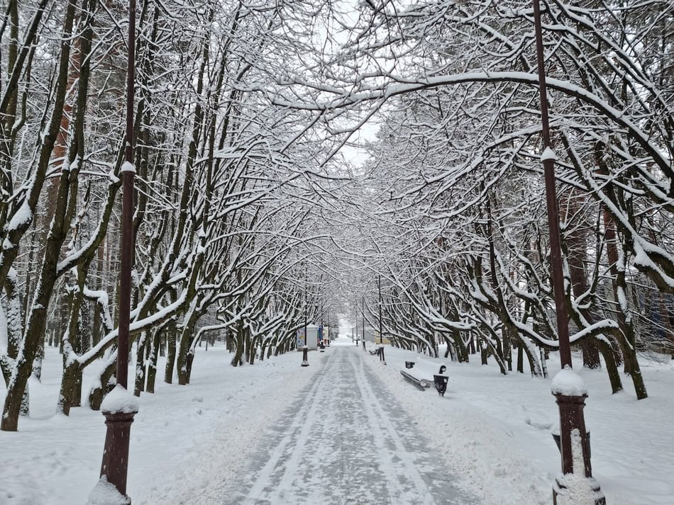
In parts of Colorado, Wyoming, Montana, and South Dakota, March can be one of the snowiest months of the year. California’s mountain snow season often builds later into winter, while New Mexico tends to receive a larger share of its snow earlier.
Take a look at our map below to see the typical snowiest month in your state.
What Is the Snowiest Month in Each State?
Here is the representative month shown on our map:
| State | Typical Snowiest Month |
|---|---|
| Alabama | January |
| Alaska | March* |
| Arizona | January |
| Arkansas | January |
| California | February |
| Colorado | March |
| Connecticut | January |
| Delaware | February |
| Florida | Little or no typical snow |
| Georgia | January |
| Hawaii | Little or no typical snow* |
| Idaho | January |
| Illinois | January |
| Indiana | January |
| Iowa | January |
| Kansas | January |
| Kentucky | January |
| Louisiana | January |
| Maine | January |
| Maryland | February |
| Massachusetts | January |
| Michigan | January |
| Minnesota | January |
| Mississippi | January |
| Missouri | January |
| Montana | March |
| Nebraska | January |
| Nevada | January |
| New Hampshire | January |
| New Jersey | February |
| New Mexico | December |
| New York | January |
| North Carolina | January |
| North Dakota | January |
| Ohio | January |
| Oklahoma | January |
| Oregon | January |
| Pennsylvania | January |
| Rhode Island | January |
| South Carolina | January |
| South Dakota | March* |
| Tennessee | January |
| Texas | January |
| Utah | January |
| Vermont | January |
| Virginia | February |
| Washington | January |
| West Virginia | January |
| Wisconsin | January |
| Wyoming | March |
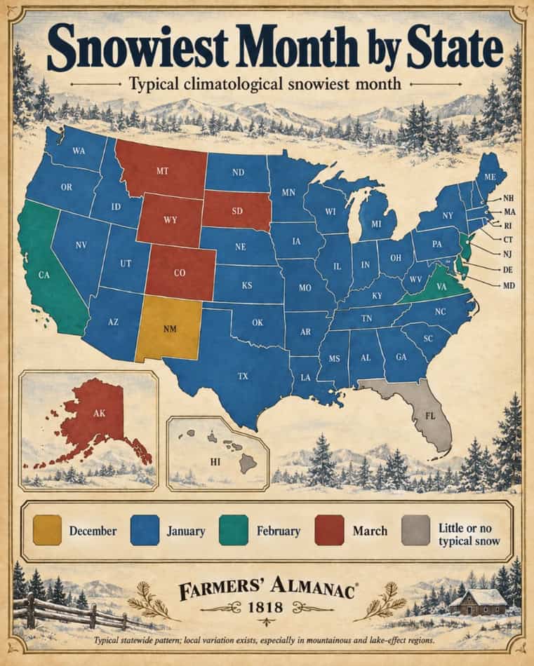
*See the regional notes below. Snowfall varies enormously within several states, particularly Alaska and the Mountain West.
January Is America’s Snowiest Month—Most of the Time
The first thing that jumps out from the map is just how much January dominates the country.
That makes meteorological sense. By January, cold air has become firmly established across much of the northern and central United States, while winter storms continue to bring moisture into those cold air masses.
In the Northeast, Upper Midwest, Great Lakes, and many interior states, January frequently produces some of the highest average monthly snowfall totals.
For example, NOAA’s 1991–2020 climate normal for Detroit shows an average of 15.1 inches of snow in January, compared with 13 inches in February and 11.4 inches in December.
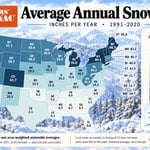
Want to know how much snow your state gets over the entire winter? See our Average Annual Snowfall by State map. How Much Snow Does Your State Get? See the 50-State Map
Why Is March So Snowy in Parts of the West?
Here is one of the biggest surprises on the map:
March can be prime snow season in portions of the Rocky Mountains and High Plains.
Colorado and Wyoming are classic examples.
Spring brings increasing moisture into the region while high elevations and continental air masses remain cold enough for substantial snowfall. When moist air is pushed upslope against mountain terrain, it cools and can produce very heavy snow.
The National Weather Service notes that March and April are favored for heavy snow east of Wyoming’s Continental Divide, with March ranking as the snowiest month at locations including Buffalo, Cody, and Torrington.
That is why a 50-degree day on the Plains doesn’t necessarily mean winter is finished in the Rockies.
Some of the biggest snowstorms of the year can arrive after people farther east are already thinking about spring.
South Dakota Has Two Very Different Snow Climates
South Dakota is another state where a simple statewide answer requires some explanation.
Western South Dakota—particularly the Black Hills—is notably snowy in March and April. The National Weather Service calls March the region’s typical snowiest month, with normal March snowfall reaching roughly 15 to 25 inches in portions of the northern Black Hills.
Eastern South Dakota has a different climate, so the March designation on our map should be viewed as a broad representation influenced strongly by the snowier western part of the state.
This is a perfect example of why state lines don’t define weather patterns.
Mountains, lakes, elevation, storm tracks, and distance from the ocean matter much more.
Why California Peaks Later Than Much of the Country
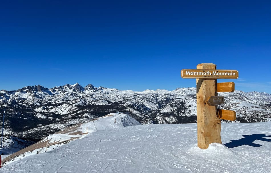
California may be famous for sunshine, but its mountains can receive extraordinary amounts of snow.
The Sierra Nevada often receives its biggest storms during the heart of the Pacific storm season. Moist air from the Pacific Ocean rises sharply over the mountains, cooling and producing heavy precipitation.
At high elevations, much of that precipitation falls as snow.
That is why California is represented as February on our map rather than January.
And the differences within California are enormous: downtown Los Angeles and a high Sierra ski area may technically be in the same state, but their winter climates could hardly be more different.
That same principle applies to states such as Arizona, Nevada, Oregon, Washington, New Mexico, and Utah.
What About New York and Lake-Effect Snow?
New York is marked January, but few states demonstrate the limitations of statewide snowfall statistics better.
New York City, the Hudson Valley, the Adirondacks, Tug Hill, Buffalo, and the Southern Tier experience very different winter climates.
Western and northern New York also receive lake-effect snow, which develops when very cold air passes over comparatively warmer Great Lakes water, picks up moisture, and deposits it as narrow bands of heavy snow downwind.
Those bands can produce feet of snow in one community while leaving another community only a short distance away with relatively little.
Read our full guide to how lake-effect snow works. What Is Lake Effect Snow?
Alaska Is Too Big for One Simple Answer
Alaska deserves an especially large asterisk.
There really isn’t a single month that can accurately describe the entire state’s snowfall climatology.
Coastal southeastern Alaska, Anchorage, the Interior, the Arctic, and Alaska’s mountain ranges all experience very different snow seasons.
For example, during March 2026, Juneau recorded an extraordinary 76.6 inches of snow, its snowiest March on record, while Anchorage received just 8.3 inches and Fairbanks 3.3 inches that month.
So although our map uses March as a broad representative category, Alaskans should rely on climate normals for their specific community.
This principle applies everywhere, but nowhere more dramatically than Alaska.
Does Hawaii Really Get Snow?
Yes—but not in the way most people imagine.
Hawaii receives snow occasionally on the highest summits, particularly Mauna Kea and Mauna Loa, where elevations exceed 13,000 feet.
Those rare high-elevation snowfalls don’t represent the climate experienced by nearly all residents, so Hawaii is shown as having little or no typical statewide snowfall.
How We Made This Map
This map is intended as a general climatological guide, not a forecast and not an official NOAA ranking of states.
Our primary reference is NOAA’s 1991–2020 U.S. Climate Normals, the current standard 30-year climatological period.
NOAA’s National Centers for Environmental Information provides monthly snowfall normals for thousands of observing stations around the country. Climate normals represent what has typically occurred over a 30-year period and are updated every decade.
We compared representative snowfall patterns within each state to identify a useful statewide month for the map.
However, NOAA does not publish an official “snowiest month by state” table.
That distinction matters.
A state such as Colorado may contain a high mountain location receiving hundreds of inches of snow each year and a lower-elevation community with dramatically different monthly snowfall.
Think of this map as a starting point—not a substitute for your hometown’s climate record.
You can explore NOAA’s station-by-station Climate Normals here. NOAA U.S. Climate Normals Quick Access
Snowiest Month vs. First Snowfall
The snowiest month is not necessarily when winter begins.
Some northern locations can see their first flakes in September or October, even though their heaviest average snowfall comes months later.
Want to know when snow typically begins where you live?
See our First Snowfall map and state-by-state guide. When Will the First Snowfall Happen Where I Live?
Preparing for Snow Season
If your state’s snowiest month is still weeks away, don’t wait for the first major storm to prepare.
Check your furnace, weather-strip doors and windows, make sure snow shovels are accessible, and prepare your vehicle for winter driving before conditions deteriorate.
Drivers who use winter tires should generally install them based on sustained cold temperatures rather than waiting for deep snow.
See our state-by-state guide: When Should You Put Snow Tires On? When to Put Snow Tires On: A State-by-State Guide
And if you enjoy the old signs people once watched for clues about the coming winter, don’t miss our collection of traditional snow lore. Snow Lore: 15 Folk Signs That Point to a Snowy Winter
Which Month Is Snowiest Where You Live?
A statewide map can tell us a lot—but longtime residents often know their local climate best.
Does this map match what you see where you live?
Is January usually your snowiest month? Does March bring your biggest storms? Or do you live in one of those places where snow can arrive almost anytime?
Tell us in the comments.
Sources
NOAA National Centers for Environmental Information, U.S. Climate Normals, 1991–2020.
National Weather Service, Wyoming Winter Weather and Snowfall Climatology.
National Weather Service Rapid City, Black Hills Climate Overview.
NOAA/NCEI, Delaware Monthly Snowfall Analysis.
Alaska Climate Research Center / University of Alaska Fairbanks, March 2026 Alaska Climate Report.


- Farmers' Almanac Staff

- Farmers' Almanac Staff
- Farmers' Almanac Staff
- Farmers' Almanac Staff