What Is Lake Effect Snow? One Expert Explains
Quick Reference
- What: Snow produced when cold dry air crosses relatively warm lake water and dumps the absorbed moisture downwind.
- Where: Great Lakes shoreline counties of NY, PA, OH, MI, and southwest Ontario. Most concentrated east of Lake Erie and Lake Ontario.
- When: Late fall through winter, before the lakes freeze over.
- Worst recent storm: Erie, PA, December 24-27, 2017. 48.9 inches in 3 days.
- Side effect: Thundersnow, lightning embedded in snowstorms.
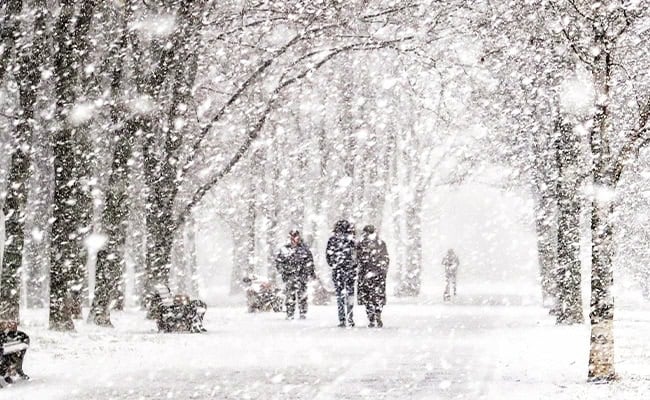
Lake effect snow occurs when dry, below-freezing air moves over relatively warm water. Lake water and the air directly above it warms and humidifies the colder air, which rises and cools, causing the humidity to condense into clouds and then fall as snow. During this process, the wind acts as a conveyor belt of humidity retrieving water vapor from lakes and depositing it on land as snow. These “conveyor belt” winds may last for more than a week, meaning incredible snow accumulation totals. Learn more about this phenomenon in our FAQ, including safety tips.

What Type Of Snow Is Lake Effect Snow?
Lake effect snow is typically light and “fluffy” due to the cold arctic air that lifts moisture off lakes, although early season lake effect snow can be heavy.
When Does It Occur?
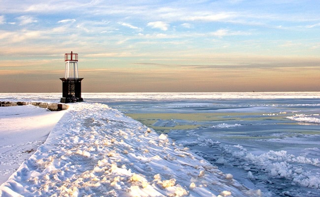
The lake effect snow phenomenon is common from late fall through winter in the Great Lakes Region of the United States when cold, arctic air moves southward from Canada and blows across the Great Lakes before their waters cool significantly. Lake effect snow occurs throughout the world, even over bays and inlets of oceans and seas, although the weather condition is most closely associated with the Great Lakes Region of North America due to its frequency there.
RELATED: 20 Signs Of A Hard Winter Ahead
Areas Known To Have Lake Effect Snow
Any location near the Great Lakes may receive lake effect snow, even those that do not typically experience it. Wind direction dictates the areas that receive these storms. Specific areas known to be affected include northwestern Pennsylvania, western, northern, and central New York, Michigan’s Upper Peninsula, northeastern Ohio, and southwestern Ontario.
Key Factors
While all lake effect snowstorms unfurl due to the same basic criteria, many factors determine exactly where snow will fall, how long it will fall, nature of the snow (light or heavy), how much snow the storm will drop, and what, if any, other types of precipitation and storm effects it will produce. These factors include lake surface water temperature, temperature and humidity of air blown over the surface of the lake, wind direction and speed, and geography of the area onto which a storm blows.
RELATED: How To Make An Onion Forecast (Onion Calendar)
Consistently ideal conditions will lead to a storm that delivers a massive rate of snowfall for as long as conditions persist, dumping feet of snow. Temperatures or humidity levels that fall outside of snow-making levels can lead to rain, sleet, graupel (tiny snow-like pellets), or simply low clouds or fog. Inconsistent conditions, including varying temperatures and wind that changes speed or direction, can end a storm quickly, then cause it to reform within a few moments.
Because meteorological conditions are rarely uniform throughout a large area, lake effect snow is often very localized. At a town where heavy snow may fall, less than a few inches may fall just a couple miles distant during a lake effect snowstorm. This localization is illustrated by satellite composite images of lake effect snowfall accumulation where distinct bands of fallen snow contrast against areas of land with little or no snowfall.

Satellite composite image of bands (white streaks) of lake effect snow extending from the southeast shore of Lake Michigan to the western Appalachian Mountains. Credit: NASA.
Landforms over which lake-effect storms flow can dramatically affect the amount of snow that falls. The Tug Hill region of New York, a highland located just east of Lake Ontario, is renowned for extreme lake effect snowfall totals. Much of Tug Hill lies at an elevation of over 1,000 feet above sea level, while the surface of Lake Ontario is 243 feet above sea level. As moisture marches east off Lake Ontario during a lake effect storm, topography forces it to rise, cooling it due to increased elevation. This process, called orographic lift, compounds the basic mechanisms of lake effect snowfall, resulting in massive totals.
Why So Dangerous?
Lake effect snow itself is not more dangerous than snow produced by other types of winter storms, but the nature of its formation means that it can defy precise prediction. While meteorologists can accurately forecast that lake effect snow is likely to occur in a general area, just how much snow will fall, and exactly where it will fall, are factors that often remain unknown until the storm has already departed.
RELATED: Lake Effect Snow Safety Tips
Being ready for prolonged, high-accumulation events whenever lake effect conditions are forecast is the best way to prepare. Those experienced with lake effect snow understand that due to the often localized nature of these storms, each one may deliver just a light dusting, or bury a neighborhood, depending on the whims of the sky.
Side Effects
Due to phenomena related to internal energy transfer within storms, lake effect events can produce more than just precipitation. These storms often give rise to gusty and erratic winds in addition to the primary “conveyor belt” wind that drives the storm. Depending on specific conditions, these storms may also produce lightning, a rare phenomenon called “thundersnow.”
Two Historical Lake Effect Snow Storms
1) Erie, Pennsylvania, 2017
At 7 p.m. on December 24, 2017, snow began falling on Erie, Pennsylvania, promising residents that they would open their eyes to a white Christmas. The snow continued unabated throughout the night, and by dawn, residents awoke to a fresh mantle of snow under the press of an accelerating storm. On Christmas day alone, Erie International Airport recorded a total of just under 21 inches. The storm intensified further on the 26th, increasing snowfall depth by another 22 inches. Five more inches fell on the morning of the 27th before the weather eased and the sky cleared.
The December 24-27 storm had dropped a total of 48.9 inches of snow, more than four feet, in less than three full days. While abnormal in magnitude, this weather event was hardly baffling to meteorologists. The intense snowfall came due to a phenomenon well known to those living in Erie and surrounding areas, lake effect snow. The Christmas storm at Erie, located on the southeast shore of Lake Erie, was one of a series of lake effect snow events to visit the city during the 2017-2018 winter season, and it contributed to that winter being a record breaker.
According to the National Weather Service, December of 2017 was the snowiest month on record for Erie, with 93.8 inches recorded (among records dating to 1893). Meteorological history is packed with extreme snowfall totals in places like Erie that experience lake effect snow, but these storms require just the right mix of conditions to form, and only a few produce snowfall like the Christmas, 2017 storm at Erie.
2) Buffalo, New York, 2006
Sometimes, the right mix of conditions can unexpectedly produce lake effect snow. On October 12, 2006, one such snow storm struck the Buffalo, New York region. Dubbed the October Surprise Storm, it dropped up to 24 inches of snow and was a contributing factor to a number of fatalities. While the National Weather Service had forecast the chance for heavy precipitation, their models indicated that rain or a rain-snow mix was most likely.

Frequently Asked Questions
What is lake effect snow?
Snow produced when cold dry air moves across relatively warm lake water, picking up moisture and dropping it as snow on the downwind shore.
Where does it occur?
Most often near the Great Lakes. Northwestern Pennsylvania, western and central New York, Michigan’s Upper Peninsula, northeastern Ohio, and southwestern Ontario are the most-affected zones.
When does lake effect snow happen?
Late fall through winter, before the lakes freeze over. Once a lake develops a stable ice cap, it stops feeding moisture to the atmosphere and the lake-effect machine shuts off.
Why is lake effect snow so localized?
Because the wind direction over the lake determines which downwind shoreline receives the snow band. Five miles can mean a foot of snow versus a dusting.
What was the worst Erie snowstorm?
December 24-27, 2017. Erie, Pennsylvania received 48.9 inches in less than three days. December 2017 became Erie’s snowiest month ever recorded with 93.8 inches.
What is thundersnow?
Lightning embedded inside a snowstorm. Lake-effect events occasionally produce it because of the strong updrafts and unstable lake-warmed air.
How do I prepare for lake effect snow?
Stock 72 hours of food, water, batteries, and medication. Charge devices ahead of the watch. Fuel a generator. Watch the local NWS and follow their lake-effect snow safety guidance.
Join The Discussion
Have you ever experienced this kind of snowfall?
Share your memories in the comments section below.
Related
20 Signs Of A Hard Winter Ahead


Ed Darack
Ed Darack is the author of a number of books and magazine articles on a variety of topics and is a contributing editor to Weatherwise Magazine and Smithsonian's Air & Space Magazine. Learn more about Ed at www.darack.com.