Scary Clouds That Look Like Tornadoes
Learn all about the many cloud formations that are often mistaken for the real thing, photos included!
Quick Reference
- Scud clouds: Low ragged cloud fragments. Look like funnels but never rotate. Harmless.
- Gustnadoes: Small ground-level whirlwinds, 30-300 ft tall, 60-80 mph possible. Not attached to storm clouds.
- Roll clouds: Horizontal tube clouds along storm outflow boundaries.
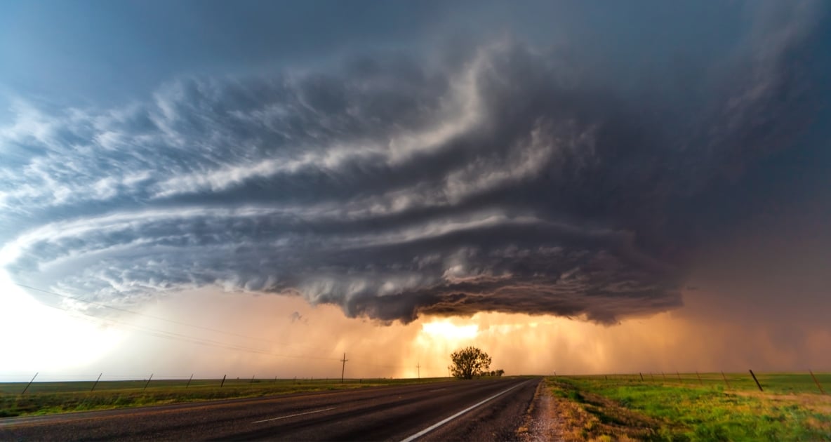
- Shelf clouds: Wedge-shaped clouds along storm leading edge. Most false tornado reports.
- Wall clouds: The dangerous one. May rotate. Tornado often forms 10-20 min after.
- Tornado test: Persistent rotation AND a column reaching from cloud to ground.
Have you ever looked up at a dark, ominous sky and seen a particularly frightening cloud formation? Fortunately for us, not every cloud that looks like a tornado is a tornado. The following cloud formations rank among those most often mistaken for tornadoes.

Scud Clouds
Scud clouds are cloud fragments that seem to hang much lower in the sky than the rest of the clouds and they can even form a point that makes them look just like a tornado. In actuality, these clouds are just smaller bits of condensation that are not attached to the higher layers of thick cumulonimbus storm clouds. They form most often when cool, moist wind meets the warm air ahead of a thunderstorm. Scud clouds are usually harmless. The key is rotation, and scuds do not rotate.
Gustnadoes
Gustnadoes look like tornadoes, but they are actually much smaller, weaker columns of rotating air. Plus, unlike a tornado, they are not attached to storm clouds at all. Instead, they sometimes develop among the winds that precede a thunderstorm, and they can rise anywhere from 30 to 300 feet in the air. Their cloudy look comes from the dust that they pick up as they swirl over the ground. While not normally dangerous, some gustnadoes can reach wind speeds of 60 to 80 mph, which is equal to the speeds of an F0 or F1 tornado.
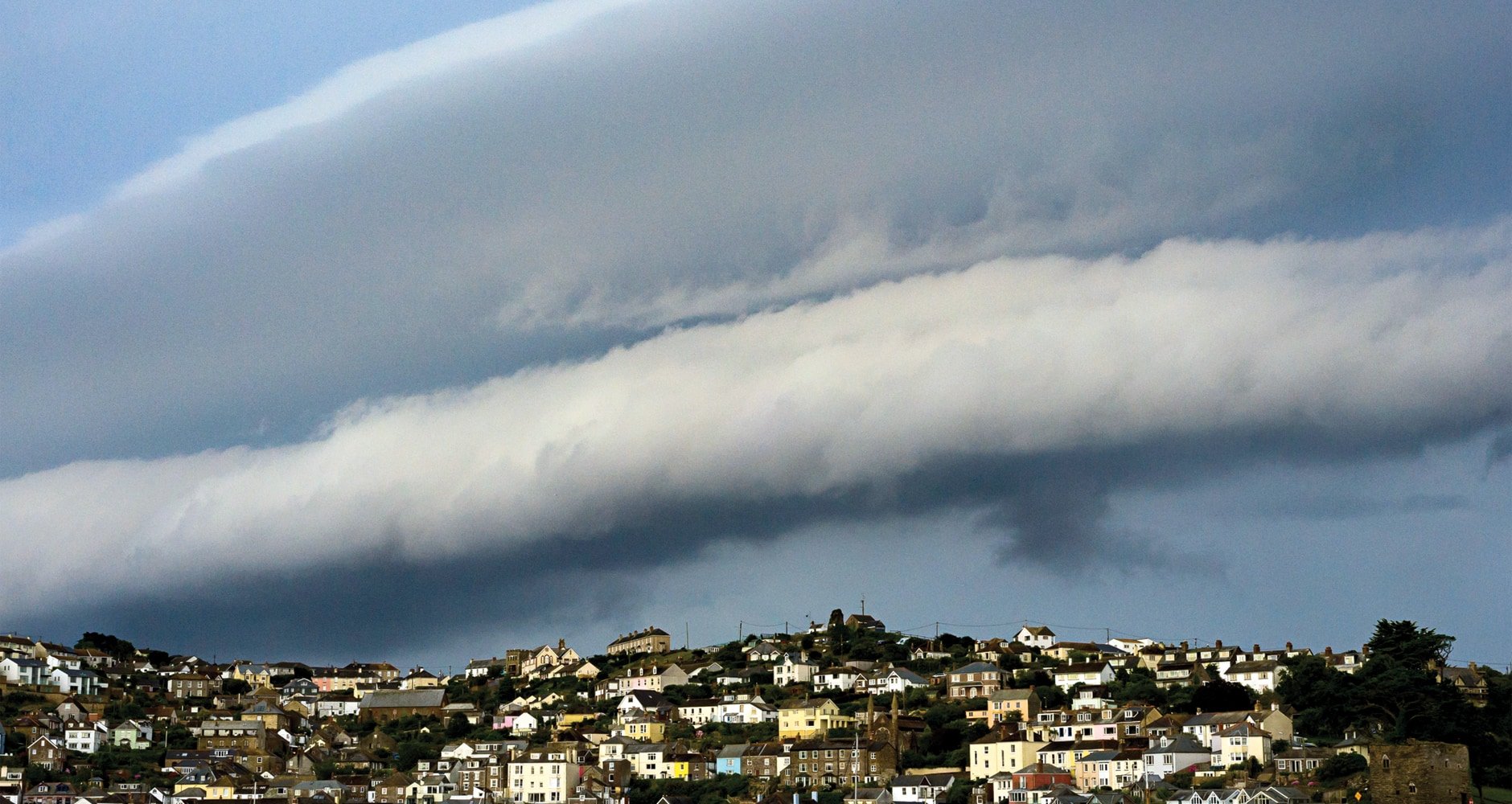
Roll Clouds
These clouds look like a gigantic tidal wave rolling across the sky. While roll clouds are not known to produce tornadoes, they do form along the leading edge or outflow boundary of some thunderstorms, and they sometimes precede dangerous storms like Derechos. Roll clouds are always horizontal and they never make contact with the ground or with the cumulonimbus clouds that form thunderstorms.
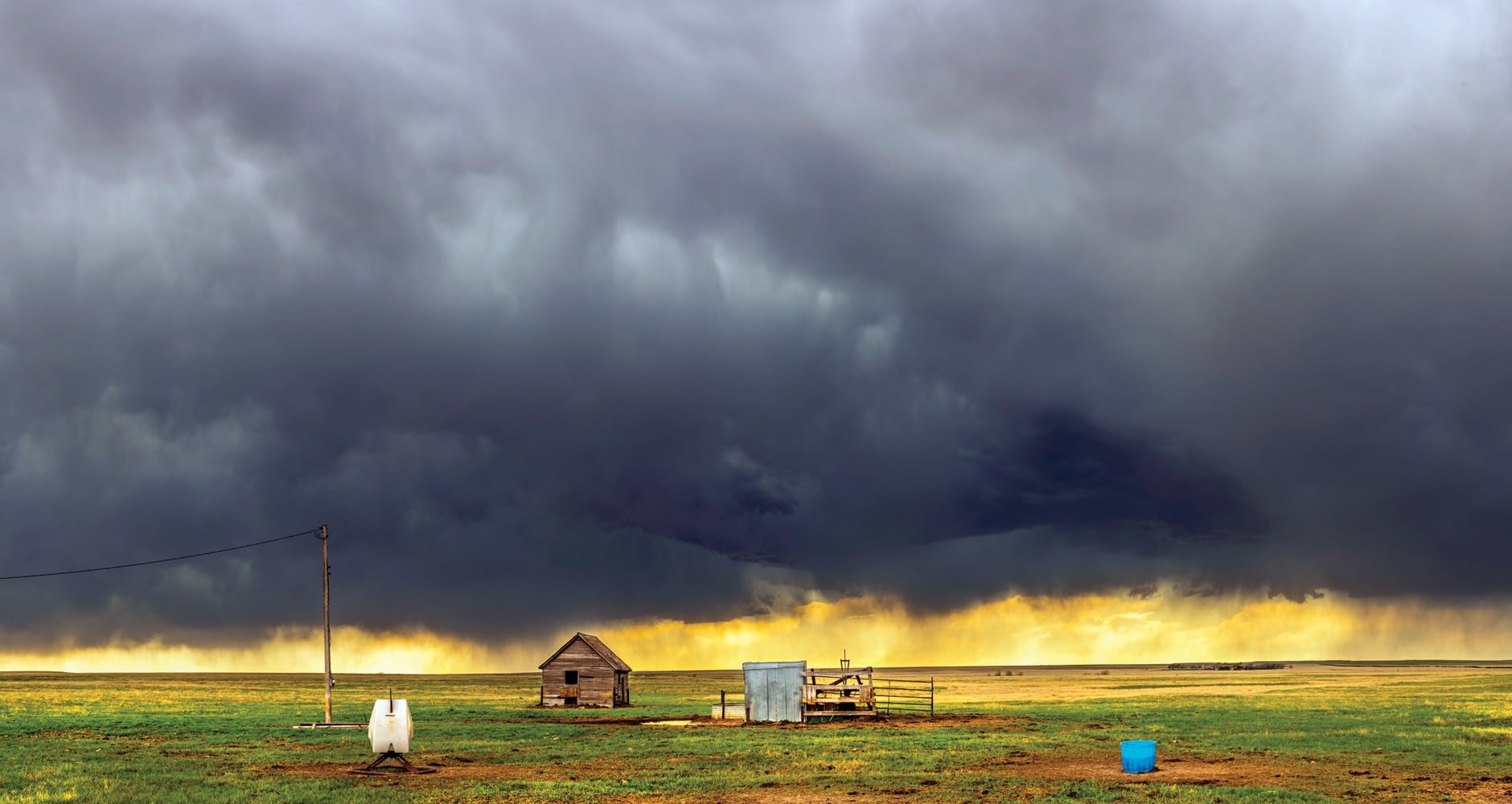
Shelf Clouds
Shelf clouds are low-hanging, horizontal wedge-shaped clouds associated with a thunderstorm. Usually there is not any persistent rotation on a vertical axis within shelf clouds or within individual cloud fragments that extend downward from the shelf cloud, therefore, they are just another scary-looking cloud. The underside of the shelf appears “boiling” and quite turbulent.
Shelf clouds often resemble big waves or tsunamis and are quite scary-looking since they are usually very low-hanging, sometimes only a couple hundred feet above the ground. Most false tornado reports are usually shelf clouds.
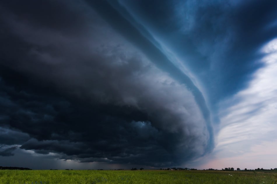
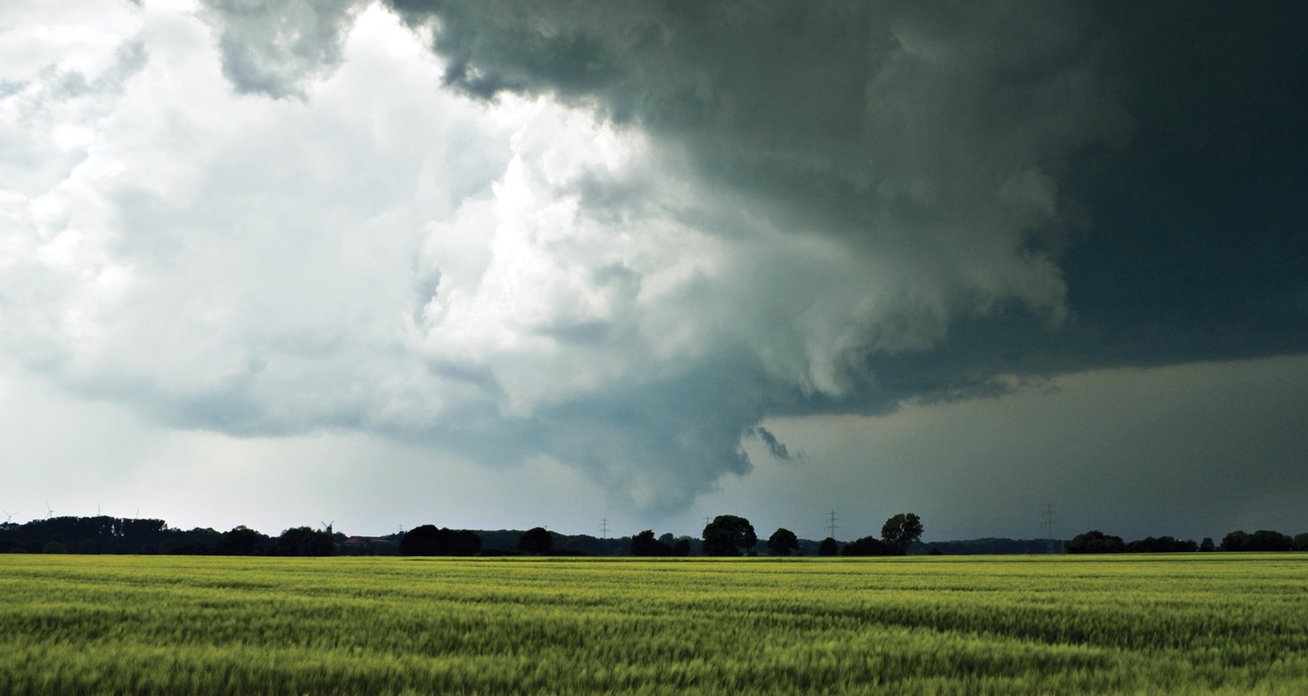
Wall Clouds
Of all the cloud formations, wall clouds are the ones that you need to watch. While not immediately dangerous, these clouds, which look like walls descending out of the sky, do sometimes produce tornadoes. Wherever there is an updraft into a cumulonimbus cloud, there is a chance for a wall cloud to form. Depending on the wind shear between the top and bottom of the cloud, they may even start to rotate. Not every wall cloud produces a tornado, but if you spot a wall cloud developing, tornado formation normally takes place between 10 and 20 minutes after the cloud first forms.
Tail Clouds
Tail clouds are a type of cloud that sometimes sprouts from wall clouds. They are caused by air flowing into the wall cloud, and they are easy to mistake for a small funnel cloud. If you watch a tail cloud closely, however, you will notice that it has no rotation.

A Tornado’s Telltale Signs
If you see a strange cloud but you are not sure whether it is a tornado or merely a lookalike, there are two things to watch for. First, tornadoes and developing funnel clouds always rotate.
However, since wall clouds and gustnadoes also rotate, you should also check the cloud’s height. A true tornado stretches from the clouds all the way to the ground. Gustnadoes, on the other hand, stay on the ground but never make contact with clouds. Wall clouds, even those that rotate like a tornado, are attached to the rest of the storm cloud but do not touch the ground. Even funnel clouds, while there is a good chance that they will turn into a tornado, are not officially classified as such until they touch down.
Even though not every cloud turns into a tornado, it still pays to use caution during storms that could produce tornadoes. If you cannot decide whether the cloud you are looking at is one of these scary-looking clouds or the real deal, the wise choice is to take cover.
Quick Field Guide
| Cloud | Rotates? | Reaches ground? | Risk |
|---|---|---|---|
| Scud | No | No | None |
| Gustnado | Yes | On ground only | Low to moderate (60-80 mph possible) |
| Roll cloud | No | No | Storm-front warning |
| Shelf cloud | No vertical rotation | No | Storm imminent |
| Wall cloud | Sometimes | No (until tornado forms) | Watch closely |
| Tornado | Yes | Yes | Take cover |
The NOAA Storm Prediction Center tracks every confirmed tornado and publishes the photo guides storm spotters use to distinguish the real thing from the lookalikes.

Frequently Asked Questions
What is a scud cloud?
A low ragged cloud fragment that often dangles below thunderstorm clouds. Looks like a funnel but does not rotate. Harmless.
What is a gustnado?
A small ground-level whirlwind, 30 to 300 feet tall, that develops in the gust front of a thunderstorm. Wind speeds can reach 60-80 mph. Not attached to a parent cloud.
What is a wall cloud?
A lowered base of a thunderstorm that hangs down like a wall. May rotate. The most reliable warning sign that a tornado may be 10-20 minutes from forming.
What is a shelf cloud?
A horizontal wedge-shaped cloud along the leading edge of a thunderstorm. The underside boils with turbulence. Most false tornado reports are shelf clouds.
How can I tell a tornado from a lookalike?
A real tornado rotates persistently AND stretches from cloud to ground. If you see persistent rotation reaching all the way down, take cover.
Are roll clouds dangerous?
The roll cloud itself is not, but it sits on the leading edge of a thunderstorm or derecho. The dangerous wind is right behind it.
If I see a wall cloud, how long do I have?
10 to 20 minutes is the typical window between wall-cloud formation and a tornado dropping, when one drops at all. Take shelter immediately and stay tuned to local NWS warnings.
Tell Us
Photographed a scary-looking cloud? Tell us in the comments. For more storm reads, see our derecho and tornado folklore entries.


Amber Kanuckel
Amber Kanuckel is a freelance writer from rural Ohio who loves all things outdoors. She specializes in home, garden, environmental, and green living topics.
- Amber Kanuckel

- Amber Kanuckel
- Amber Kanuckel
- Amber Kanuckel


My father got me into cloud watching, on my way home the sky was somewhat clear but a white cloud caught my attention. When I got to where it was, it was a white out of rain and windy. I had to pull over til it passed. It was amazing to some degree.
in my town, I saw a cloud the was touching the ground but it wasn’t rotating or doing and damage to our city it wasn’t rain because it wasn’t raining anywhere else it was like standing still about maybe less than 1 mile from my house I found out what it was but I forgot I just want to know what it is. And there was no storm even nearby
I have seen a lot of creepy tornado pictures in my life time. And I love tornadoes a lot
great photos
I saw a cloud the other day that I have never before seen, especially here in California, home to boring weather. In some ways it resembles your description of a scud, and in others a funnel.
It was columnar in shape, descending towards the ground at an angle of perhaps 60º below the cloud base roughly in the direction of the cloud base movements (northerly‚ system was coming from southwest). It did not contact the ground. It was highly structured, evolving right before my eyes over the course of a few minutes, from a distinct narrow funnel hanging from the cloud base then fattening into a thick straight-sided cylinder. It was incompletely connected to the cloud base above it. It was rotating fairly rapidly—no time lapse needed in order to see this—but certainly not as fast as a tornado. It eventually began to breakup, stopped rotating, and turned into ordinary low-hanging scud.
The weather system it was associated with was not conducive to producing tornadoes. Clouds were a moderate collection of cumulus, some thick and dark, most light and fluffy, that had produced a few showers as they moved north. The system simply did not have the strength, density, size, nor organization necessary for a true tornado.
The landscape is a wide flat valley between mountain ranges (the Central Valley of California), and the day was very warm and humid. The clouds and bit of rain provided the only relief from high 90s and triple digit temps we’ve seen for a while. This system never did develop into a real storm.
The time was early afternoon, right about the time when summer temps start to get hot. date: 9.16.19.
This cloud puzzles me because it certainly was not a tornado, nor even the threat of one, but it had definite bounded structure and rotated, so it was not entirely scud either. Is there some kind of weird hybrid?
Naturally, I saw this wonderful thing when I didn’t have a camera with me.
I saw one of those things you were talking about right over my neighborhood in Pennsylvania, and it formed gust as quickly (pun intended). It was shaped like a giant can of canned tomato sauce, with extra can, but shorter(ish). Some lightning was coming out of it and going back into it, lighting MY strange, rotating cloud up. It looked like something out of a fiction book, but it didn’t do anything.
My phone was able to record it, but I took so many other picture and videos that I think I had to delete it.
I forget the exact date and time, but I think it was last year.
Today, I remembered it and tried to search images on google, but I only found cumulonimbus, roll cloud, and tornado, but it obviously wasn’t any of those. So then I searched for “clouds that look like tornadoes but aren’t” and found this. I then looked at this comment and found that I am not the only one who saw a cloud like the one I found.
Hi,I am kida scared of a tornado some times i wish tornados whert real
This sounds like the stereotypical wall cloud. The picture of the “wall cloud” in this article is terrible. Can’t see the wall. A google search can confirm this though
When I saw your pic I thought you were Christina Ricci, but you are Amber Kanuckel. I take many pics of clouds, one of my favorite past times. I often see the Tail Clouds and did think that they are makings of a tornado. But thanks to your great article, I don’t think I’ll think that anymore, only if they are not rotating!! I live in central California and do not experience being in fear of tornados, but you never know, right!?!
I look forward to reading more articles by you Amber Kanuckel.
Very informative. I think I saw a scud cloud a few months ago and was wondering what it was.
‘@Colorado Slim: Thank you! 🙂 Glad you enjoyed it!
kckoen: Usually, if a Tornado “skips”, that is, comes down, lifts up, comes back down, its considered a single tornado from initial contact with the ground to the last time ir comes up, providing points of contact are relatively close in time and or location. Its a Judgement thing, usually left to the weatherguessers, and while one can argue the semantics, with a tornado on the ground its just easier to say “we have an active tornado, take cover” than ” well it was on the ground we think it’ll come back… oh, wait, yep, its onthe ground again. No, its back up in the air…”
Good info, Morgan Davis. Thank you!
This article and photos were so good I figured Jaime was the author till I got to the bottom. Thanks Amber, you knocked it out of the park!