Farmers’ Almanac 2026–2027 Winter Weather Forecast for Canada


Snow, Sleet, and Surprises!
What will winter 2026–2027 in Canada be like?
The Farmers’ Almanac Canada winter forecast for 2026–2027 is calling for a season of dramatic contrasts—from rainy, windy weather along the British Columbia coast to Arctic cold and blizzards across the Prairies, frequent snow and icy conditions around the Great Lakes, and an active mix of snow, sleet, freezing rain, and coastal storms across eastern Canada.
Our theme for the upcoming winter says it all:
Snow, Sleet, and Surprises!
Rather than one continuous coast-to-coast deep freeze, winter 2026–2027 looks increasingly like a season of frequent changes, sharp temperature swings, and an active storm track.
Milder stretches may be interrupted by sudden outbreaks of Arctic air. Snowstorms may transition to sleet or rain before temperatures plunge again. And in areas where temperatures hover close to freezing, even a small shift in a storm’s track could mean the difference between rain, heavy wet snow, or a dangerous coating of ice.
The same large-scale pattern behind our 2026–2027 U.S. Winter Weather Forecast will also have important implications north of the border. The U.S. outlook calls for sharp contrasts, an active southern storm track, northern cold outbreaks, and particularly difficult rain-snow-ice boundaries.
And there is another major player to watch this winter: El Niño.
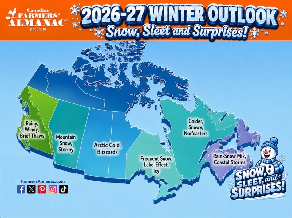

Canada Winter Forecast 2026–2027 At A Glance
Here is the regional Farmers’ Almanac winter outlook for Canada:
- British Columbia Coast: Rainy, windy, with brief thaws
- Interior British Columbia: Mountain snow and stormy periods
- Alberta, Saskatchewan & Manitoba: Arctic cold and blizzards
- Ontario: Frequent snow, lake-effect snow, and icy conditions
- Quebec & Labrador: Colder, snowy, with nor’easter threats
- Atlantic Canada: Rain-snow mixes and coastal storms
- Northern Canada: Persistent winter cold with periodic Arctic outbreaks
For more detailed forecasts throughout the season, visit the Farmers’ Almanac Long-Range Weather Forecast for Canada. It includes forecast regions for British Columbia, the Prairie Provinces, Ontario, Quebec and the Maritimes, and Newfoundland and Labrador.
El Niño Could Play A Major Role In Winter 2026–2027
One of the biggest pieces of the winter forecast puzzle this year is the strengthening El Niño in the tropical Pacific.
NOAA’s Climate Prediction Center issued an El Niño Advisory on August 13, 2026, reporting that El Niño is strengthening and that there is a greater than 90% chance of a very strong El Niño during Northern Hemisphere fall and winter 2026–2027. NOAA also cautions that even a strong event does not guarantee identical weather impacts everywhere.
You can follow NOAA’s official ENSO Diagnostic Discussion for the latest updates.
Want to understand why this matters? Read our guide to what El Niño is and how it changes winter weather patterns.
For Canada, El Niño can help rearrange the jet stream and storm tracks, increasing the possibility of a winter characterized by regional contrasts rather than uniform cold.
That doesn’t mean Canada escapes winter.
Far from it.
Even during an El Niño-influenced season, Arctic air can build across northern Canada and surge southward in short but intense bursts. At the same time, moisture-rich storms moving across North America can encounter that cold air and produce snow, sleet, freezing rain, or rapidly changing precipitation types.
In short, the setup is ideal for a winter of surprises.
British Columbia Winter Forecast 2026–2027
Pacific Coast: Rainy, Windy, Brief Thaws
The British Columbia winter forecast for 2026–2027 calls for a generally wet and changeable pattern along the Pacific Coast.
Vancouver, Victoria, and surrounding coastal areas should prepare for repeated periods of rain, gusty winds, and occasional heavier Pacific storms.
Mild Pacific air should also allow for periodic thaws and stretches of comparatively comfortable winter temperatures.
But don’t assume mild means quiet.
Strong Pacific systems can bring heavy precipitation and wind, while temporary intrusions of colder continental air can occasionally push snow or mixed precipitation into lower elevations.
Overall, coastal BC should experience a winter that is wetter than it is relentlessly snowy, with plenty of swings between rainy storm periods and brief milder breaks.
British Columbia Coast Forecast:
Rainy. Windy. Brief Thaws.
Environment and Climate Change Canada notes that Canada’s West Coast receives much of its winter precipitation as rain because of the moderating influence of the Pacific Ocean, while snowfall increases dramatically farther inland and through the mountains. Learn more about Canada’s cold-season weather hazards.
Interior British Columbia Winter Forecast
Mountain Snow, Stormy
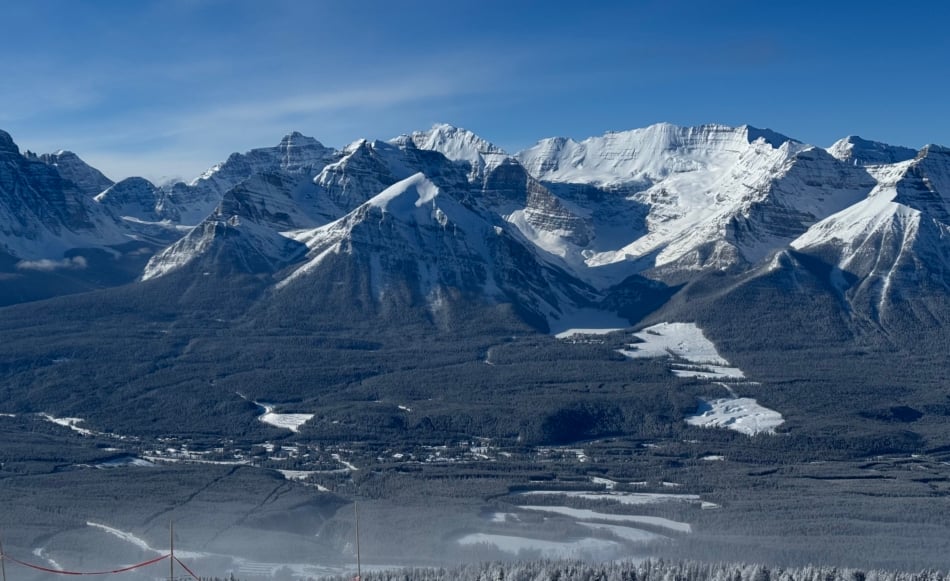
Travel inland and upward, and winter should look much different.
The interior of British Columbia and its mountain ranges should see repeated opportunities for significant mountain snowfall as Pacific storms push inland.
The Coast Mountains, Columbia Mountains, Rockies, and higher-elevation travel corridors could experience periods of heavy snow, blowing snow, and difficult travel.
Valleys may alternate among snow, mixed precipitation, and occasional milder interludes, while higher elevations remain considerably more wintry.
This could be good news for ski country—but not necessarily for travellers trying to cross mountain passes during the strongest storms.
Interior BC Forecast:
Mountain Snow. Stormy.
Alberta, Saskatchewan & Manitoba Winter Forecast 2026–2027
Arctic Cold And Blizzards
The Prairie Provinces winter forecast may contain some of Canada’s most dramatic temperature swings.
Alberta, Saskatchewan, and Manitoba should prepare for periodic surges of Arctic cold, dangerous wind chills, strong winds, blowing snow, and possible blizzard conditions.
The key word is periodic.
This does not necessarily look like one uninterrupted season-long deep freeze. Instead, periods of relatively milder weather may be followed by sudden southward dives of bitter Arctic air.
That can create substantial temperature swings in a matter of days.
Alberta could experience especially abrupt changes when milder Pacific or Chinook-influenced air collides with incoming Arctic air.
Saskatchewan and Manitoba may have a harder time shaking the cold once Arctic high pressure becomes established.
Fast-moving winter systems may also contribute to sudden snow and wind events across the Prairies.
Learn more about the classic Alberta Clipper, a fast-moving storm system closely associated with quick shots of snow, wind, and colder air across central North America.
Prairie Provinces Forecast:
Arctic Cold. Blizzards.
January and February appear to offer the greatest potential for some of the winter’s harsher cold outbreaks.
Ontario Winter Forecast 2026–2027
Frequent Snow, Lake-Effect Snow, And Ice
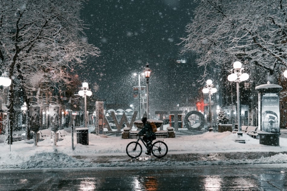
Ontario may sit near one of the most active battlegrounds of the entire 2026–2027 Canadian winter.
The province will have multiple sources of winter weather to contend with.
Cold northwest winds moving across the relatively warmer Great Lakes can generate intense bands of lake-effect snow, while larger storm systems approaching from the southwest may bring widespread snow, sleet, freezing rain, or rain.
That means southern Ontario could see frequent changes in precipitation type.
Toronto, Hamilton, London, Windsor, Ottawa, and surrounding communities may experience storms in which temperatures hover dangerously close to 0°C.
One storm may be mostly snow.
The next may begin as snow, change to freezing rain or rain, and then flash-freeze as colder air rushes in behind it.
Snowbelt communities east and southeast of the Great Lakes should remain particularly alert for localized heavy snowfall.
Our guide to lake-effect snow explains how cold air crossing the Great Lakes can absorb moisture and then release it as concentrated snow bands downwind.
Ontario Forecast:
Frequent Snow. Lake-Effect. Icy.
Northern Ontario should generally experience a more persistently wintry pattern, while southern areas contend with more frequent freeze-thaw cycles and mixed precipitation.
Quebec Winter Forecast 2026–2027
Colder, Snowy, Nor’easters
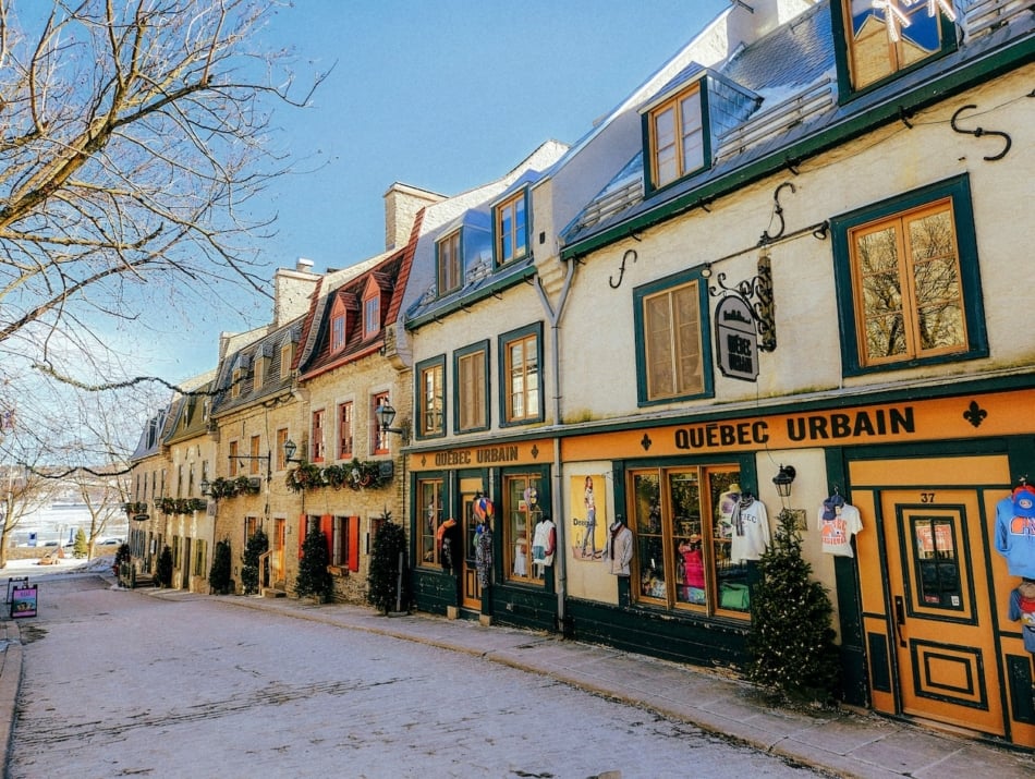
The Quebec winter forecast for 2026–2027 favours more consistently wintry conditions than many areas farther south and west.
Cold air should be readily available across much of the province, giving incoming storm systems a better chance of producing accumulating snow rather than rain.
Southern Quebec may still experience periodic thaws and mixed precipitation, especially when warmer air pushes northward ahead of a strong storm.
But as you travel farther north and east, winter should become increasingly entrenched.
Montreal and the St. Lawrence Valley may find themselves close to the rain-snow dividing line during some major systems, while central and northern Quebec should have better odds of remaining all snow.
Quebec should also watch for coastal storms moving northward along eastern North America.
If enough cold air is in place, these systems could produce heavy snowfall, gusty winds, and nor’easter-type conditions.
Quebec Forecast:
Colder. Snowy. Nor’easters.
Labrador Winter Forecast 2026–2027
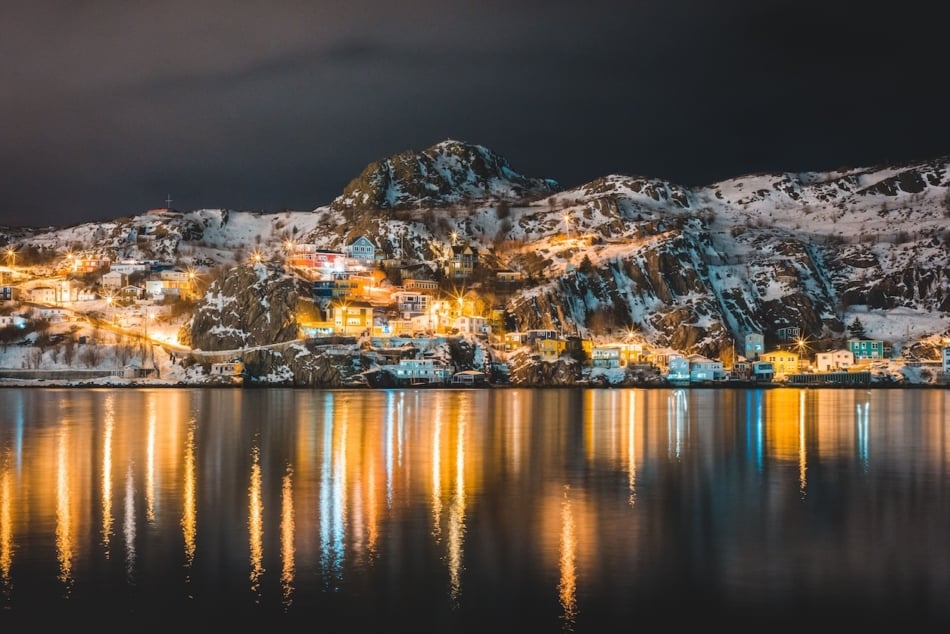
Labrador should remain on the colder side of this winter’s pattern.
Periodic coastal systems combined with readily available cold air could produce substantial snow and blowing snow, while Arctic air remains close enough to deliver prolonged bouts of bitter temperatures.
Strong storms travelling northeastward toward the Labrador Sea may become especially important during the heart of winter.
Labrador Forecast:
Cold, Snowy, And Storm-Prone.
Atlantic Canada Winter Forecast 2026–2027
Rain-Snow Mix And Coastal Storms
Atlantic Canada may experience the most complicated precipitation forecast of any Canadian region this winter.
New Brunswick, Nova Scotia, Prince Edward Island, and Newfoundland should all prepare for an active mix of snow, sleet, freezing rain, rain, and strong coastal storms.
And sometimes several of those may occur during the same storm.
The Atlantic Ocean provides abundant moisture, but coastal temperatures can frequently remain close enough to freezing that relatively small shifts in storm track or wind direction make a huge difference.
A storm tracking slightly farther offshore could produce widespread heavy snow.
Move that storm farther west, and warmer Atlantic air may push inland, changing snow to sleet, freezing rain, or ordinary rain.
Interior New Brunswick and higher-elevation areas generally have better chances of remaining snow, while exposed coastal areas will have a greater risk of mixed precipitation and rain.
Newfoundland may experience particularly dramatic contrasts as cold continental air repeatedly collides with moisture and relatively milder air from the North Atlantic.
Atlantic Canada Forecast:
Rain-Snow Mix. Coastal Storms.
Understanding the difference among winter precipitation types will be especially useful this season. See our guide to sleet vs. freezing rain. Freezing rain remains particularly hazardous because liquid precipitation freezes when it contacts subfreezing surfaces.
Northern Canada Winter Forecast 2026–2027
Cold Remains In Control
Across Yukon, the Northwest Territories, Nunavut, and the Arctic Archipelago, winter will remain unmistakably winter.
Northern Canada should experience prolonged stretches of cold weather, though even the far North may see fluctuations as the upper-level pattern evolves.
What happens here also matters greatly to Canadians living thousands of kilometres farther south.
Pools of extremely cold Arctic air can build across northern Canada before being pushed into the Prairies, Ontario, Quebec, and occasionally all the way toward the Atlantic Coast.
Those southward surges of Arctic air could become responsible for some of the most memorable cold spells of winter 2026–2027.
Northern Canada Forecast:
Cold, Wintry, With Periodic Arctic Outbreaks.
Where Will Canada Get The Most Snow In Winter 2026–2027?
Several regions stand out for repeated snow opportunities.
Interior British Columbia And The Mountains
Pacific storms should provide numerous opportunities for mountain snowfall across higher elevations of British Columbia.
Ontario Snowbelts
Areas downwind of the Great Lakes could see repeated lake-effect snow events when Arctic air passes over open lake water.
Quebec And Labrador
These regions should have colder air available more consistently, improving the chances that major winter storms fall primarily as snow.
Atlantic Canada
Snow totals could vary dramatically from storm to storm. Atlantic systems may produce heavy snowfall inland while changing to rain or mixed precipitation closer to the coast.
The Prairies
The Prairies may not always receive the greatest overall precipitation totals, but snow combined with high winds can create dangerous blowing and drifting snow and occasional whiteout conditions.
Will Canada Have A Cold Winter In 2026–2027?
Yes—but not everywhere, and not continuously.
One of the defining characteristics of the 2026–2027 winter may be its temperature variability.
Canada should still experience potent Arctic outbreaks. The Prairies, northern Ontario, northern Quebec, Labrador, and the territories have the greatest potential for intense cold.
However, southern and coastal regions may experience more frequent interruptions from comparatively mild air.
That means this winter may be remembered less for uninterrupted cold than for dramatic transitions:
mild → cold → storm → thaw → flash freeze → cold again.
Those temperature swings may become particularly important in Ontario, Quebec, and Atlantic Canada.
Will Canada Get A Lot Of Snow In Winter 2026–2027?
Some parts of Canada could certainly have a snowy winter, but snowfall is unlikely to be evenly distributed.
Cold alone doesn’t create snow.
You need moisture and an atmospheric mechanism capable of lifting that moisture.
Regions where cold Canadian air repeatedly meets moisture-rich storms will have the greatest opportunities for significant snowfall.
That places interior BC, the Great Lakes snowbelts, portions of Ontario, Quebec, Labrador, and parts of Atlantic Canada among the areas to watch.
But in southern and coastal communities, a difference of just a few degrees could turn what appears to be a major snowstorm into rain, sleet, or freezing rain.
Could Canada See More Freezing Rain And Ice?
Yes. Ice may be one of the biggest wild cards of winter 2026–2027.
Whenever warm air overrides a shallow layer of subfreezing air at the surface, precipitation can reach the ground as freezing rain.
Environment and Climate Change Canada explains that freezing rain falls as liquid water but freezes when it contacts surfaces that are below freezing, creating hazardous ice accumulation on roads, trees, and utility infrastructure.
Southern Ontario, southern Quebec, New Brunswick, Nova Scotia, and parts of Prince Edward Island may be particularly vulnerable when storm tracks place them near the freezing line.
And there is another threat: flash freezing.
A system may produce ordinary rain before a strong Arctic front arrives. Once temperatures fall rapidly below freezing, standing water can become ice.
Keep the ice scraper handy.
When Will Winter 2026–2027 Be Worst In Canada?
December 2026: A Changeable Start
December may introduce the pattern gradually, with periods of storminess interrupted by milder stretches.
Western Canada may see frequent Pacific systems while developing cold outbreaks begin pushing farther south from the Arctic.
Eastern Canada should see increasing opportunities for snow and mixed precipitation as the month progresses.
January 2027: Winter Turns More Aggressive
January could bring some of the most significant swings of the season.
Watch for Arctic cold across the Prairie Provinces and central Canada, lake-effect snowfall around the Great Lakes, and an increasing threat of coastal winter storms farther east.
Quick transitions from mild weather to bitter cold may become a recurring theme.
February 2027: Snow, Cold, And Storms Continue
February should remain active.
Cold air entrenched across parts of Canada may interact with moisture-rich storm systems, creating opportunities for significant snow in Ontario, Quebec, Labrador, and portions of Atlantic Canada.
Meanwhile, the Prairies could see additional episodes of severe cold and blowing snow.
March 2027: Don’t Declare Spring Too Early
Canadians know better than most that March can deliver false starts.
Milder weather may begin making progress in southern regions, but the atmosphere can still produce late-season snowstorms and cold snaps.
A winter with strong temperature contrasts can be particularly good at delivering one final surprise.
Winter 2026–2027: A Season Of Contrasts
The best way to describe the 2026–2027 Canada winter weather forecast may be one word:
changeable.
Look for:
British Columbia Coast: Rain, wind, and occasional thaws.
Interior BC: Mountain snow and stormy periods.
Prairies: Arctic cold, wind, and blizzards.
Ontario: Frequent snow, lake-effect squalls, freezing rain, and ice.
Quebec and Labrador: Colder, snowier weather with potential coastal storms.
Atlantic Canada: Snow, rain, sleet, freezing rain, and powerful coastal systems.
Northern Canada: Persistent cold and the source region for periodic southward Arctic outbreaks.
It may not be a relentlessly cold winter everywhere.
But it could be a remarkably active one.
Prepare Now For Winter Weather
Whatever the long-range outlook says, always rely on current forecasts and official weather alerts when hazardous weather approaches.
Environment and Climate Change Canada warns that Canadian winter weather can become dangerous quickly and issues alerts for hazards including winter storms, blizzards, freezing rain, snowfall, extreme cold, and other severe conditions. Review Canada’s official winter weather preparedness guidance.
Before winter arrives:
- Check your home’s heating system.
- Keep emergency supplies available.
- Make sure vehicles are winter-ready.
- Keep snow removal equipment accessible.
- Prepare for possible power outages during ice or wind storms.
- Monitor local weather forecasts before travelling.
And don’t miss our favorite winter tips and cold-weather life hacks.
The Bottom Line: What Will Winter 2026–2027 Be Like In Canada?
The Farmers’ Almanac Canada winter forecast for 2026–2027 calls for a winter packed with contrasts.
Pacific rain.
Mountain snow.
Prairie blizzards.
Great Lakes snow squalls.
Quebec snowstorms.
Atlantic rain, sleet, ice, and nor’easters.
And periodic blasts of Arctic air tying it all together.
With a strengthening El Niño influencing the broader North American pattern and an active storm setup increasing the potential for shifting precipitation types, Canadians should be ready for winter weather that can change quickly.
The shovel will have its days.
So will the umbrella.
And there may be mornings when the ice scraper gets the most use of all.
Winter 2026–2027: Snow, Sleet, and Surprises!
Check the Farmers’ Almanac Long-Range Weather Forecast throughout the season for more detailed regional predictions.
Canada Winter Forecast 2026–2027 FAQs
What is the Farmers’ Almanac prediction for winter 2026–2027 in Canada?
The Farmers’ Almanac outlook calls for a changeable winter with sharp regional contrasts: rain and wind along coastal BC, mountain snow inland, Arctic cold and blizzards across the Prairies, frequent snow and ice in Ontario, colder and snowier conditions in Quebec and Labrador, and rain-snow mixes with coastal storms across Atlantic Canada.
Will winter 2026–2027 be cold in Canada?
Canada will experience significant periods of cold, particularly across the Prairies, northern Ontario, northern Quebec, Labrador, and northern Canada. Southern and coastal regions may see more frequent thaws and temperature swings.
Will Ontario get a lot of snow in winter 2026–2027?
Ontario has a strong chance of frequent snow opportunities, including lake-effect snow near the Great Lakes. Southern Ontario may also experience mixed precipitation and freezing rain when storm temperatures hover around freezing.
Will Alberta have a cold winter in 2026–2027?
Alberta should prepare for periodic Arctic outbreaks, sharp temperature drops, strong winds, snow, and potential blizzard conditions. Milder Chinook periods may temporarily interrupt the cold.
What is the winter 2026–2027 forecast for British Columbia?
Coastal British Columbia should be generally rainy and windy with occasional thaws, while interior and mountainous BC should experience a substantially snowier and stormier winter.
What is the winter forecast for Quebec in 2026–2027?
Quebec should experience colder and snowier periods, with opportunities for significant winter storms. Southern Quebec may occasionally see mixed precipitation, while northern and eastern sections should remain colder.
Will Atlantic Canada have a snowy winter?
Atlantic Canada should see plenty of winter precipitation, but not all of it will be snow. Coastal storms may bring rapidly changing mixtures of snow, sleet, freezing rain, and rain.
How will El Niño affect Canada’s winter in 2026–2027?
El Niño can influence jet-stream patterns and storm tracks across North America, but its effects vary by region and from one event to another. NOAA reported in August 2026 that El Niño was strengthening and had a greater than 90% chance of becoming very strong during fall and winter 2026–2027.
For the latest ENSO conditions, consult the NOAA Climate Prediction Center.
Where can I find my local Canadian long-range weather forecast?
Visit the Farmers’ Almanac Long-Range Weather Forecast to find Canadian forecasts for British Columbia, Alberta/Saskatchewan/Manitoba, Ontario, Quebec and the Maritimes, and Newfoundland and Labrador.


Caleb Weatherbee
Caleb Weatherbee is the official forecaster for the Farmers' Almanac. His name is actually a pseudonym that has been passed down through generations of Almanac prognosticators and has been used to conceal the true identity of the men and women behind our predictions.
- Caleb Weatherbee

- Caleb Weatherbee
- Caleb Weatherbee
- Caleb Weatherbee